HKT Hockley, Texas - Earthquake Result Viewer
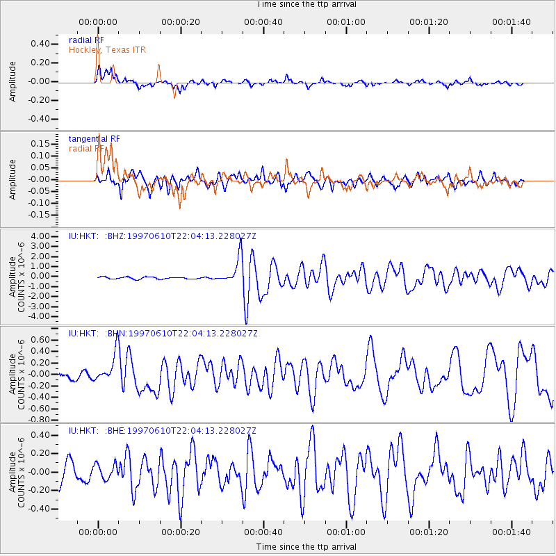
Earthquake location: Southern East Pacific Rise
Earthquake latitude/longitude: -35.8/-108.1
Earthquake time(UTC): 1997/06/10 (161) 21:53:55 GMT
Earthquake Depth: 10 km
Earthquake Magnitude: 5.8 MB, 6.1 MS, 6.5 UNKNOWN, 5.8 MS
Earthquake Catalog/Contributor: WHDF/NEIC
Network: IU Global Seismograph Network (GSN - IRIS/USGS)
Station: HKT Hockley, Texas
Lat/Lon: 29.96 N/95.84 W
Elevation: -413.0 m
Distance: 66.4 deg
Az: 11.632 deg
Baz: 190.885 deg
Ray Param: 0.057612777
Estimated Moho Depth: 32.0 km
Estimated Crust Vp/Vs: 1.76
Assumed Crust Vp: 5.581 km/s
Estimated Crust Vs: 3.162 km/s
Estimated Crust Poisson's Ratio: 0.26
Radial Match: 82.39665 %
Radial Bump: 363
Transverse Match: 80.14345 %
Transverse Bump: 400
SOD ConfigId: 6273
Insert Time: 2010-03-02 13:53:14.385 +0000
GWidth: 2.5
Max Bumps: 400
Tol: 0.001

Signal To Noise

ChannelStoNSTALTA
IU:HKT: :BHN:19970610T22:04:13.228027Z3.24943642.678328E-78.2424386E-8
IU:HKT: :BHE:19970610T22:04:13.228027Z0.88449978.4035406E-89.500897E-8
IU:HKT: :BHZ:19970610T22:04:13.228027Z13.3782521.4274983E-61.067029E-7
Arrivals
Ps4.5 SECOND
PpPs15 SECOND
PsPs/PpSs20 SECOND