
HKT Hockley, Texas - Earthquake Result Viewer
| ||||||||||||||||||
| ||||||||||||||||||
| ||||||||||||||||||
|
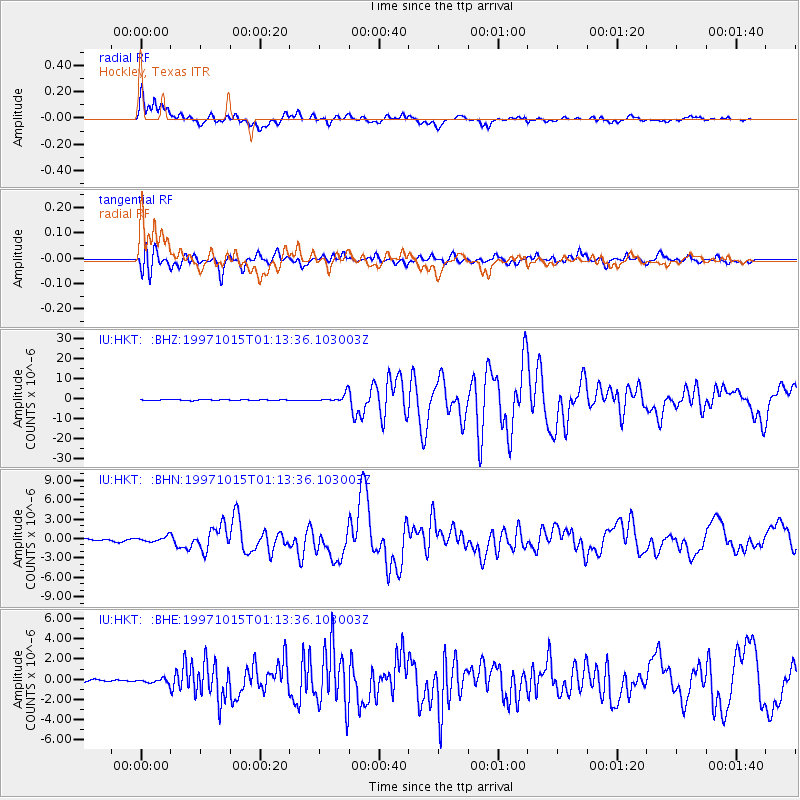
Signal To Noise
| Channel | StoN | STA | LTA |
| IU:HKT: :BHN:19971015T01:13:36.103003Z | 3.0841382 | 4.1545303E-7 | 1.3470637E-7 |
| IU:HKT: :BHE:19971015T01:13:36.103003Z | 1.6310266 | 2.1356698E-7 | 1.3094022E-7 |
| IU:HKT: :BHZ:19971015T01:13:36.103003Z | 10.4235735 | 2.1737167E-6 | 2.0853854E-7 |
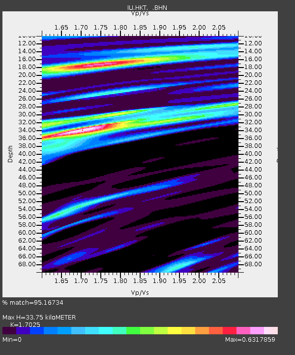
| Arrivals | |
| Ps | 4.4 SECOND |
| PpPs | 16 SECOND |
| PsPs/PpSs | 20 SECOND |

