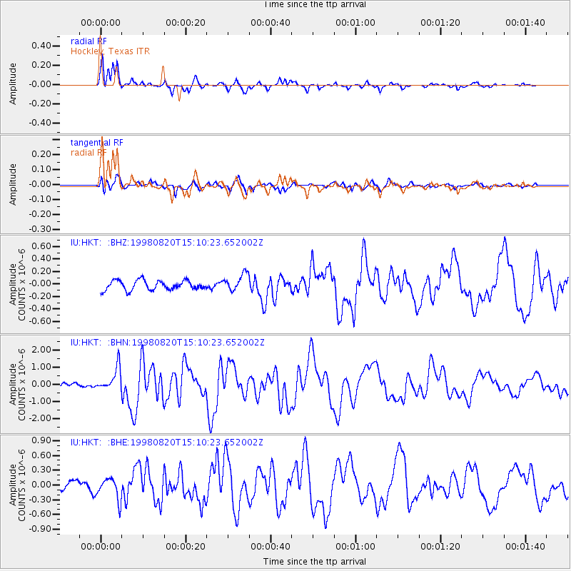
HKT Hockley, Texas - Earthquake Result Viewer
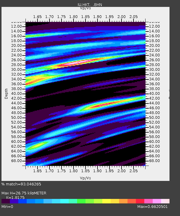
Earthquake location: Rat Islands, Aleutian Islands
Earthquake latitude/longitude: 51.6/175.2
Earthquake time(UTC): 1998/08/20 (232) 15:00:08 GMT
Earthquake Depth: 33 km
Earthquake Magnitude: 5.6 MB, 6.0 MS, 6.2 UNKNOWN, 6.2 MW
Earthquake Catalog/Contributor: WHDF/NEIC
Network: IU Global Seismograph Network (GSN - IRIS/USGS)
Station: HKT Hockley, Texas
Lat/Lon: 29.96 N/95.84 W
Elevation: -413.0 m
Distance: 66.5 deg
Az: 71.107 deg
Baz: 317.177 deg
Ray Param: 0.057523474
Estimated Moho Depth: 26.75 km
Estimated Crust Vp/Vs: 1.82
Assumed Crust Vp: 5.581 km/s
Estimated Crust Vs: 3.071 km/s
Estimated Crust Poisson's Ratio: 0.28
Radial Match: 93.046265 %
Radial Bump: 315
Transverse Match: 74.95867 %
Transverse Bump: 400
SOD ConfigId: 4480
Insert Time: 2010-03-02 13:54:18.269 +0000
GWidth: 2.5
Max Bumps: 400
Tol: 0.001

Signal To Noise

ChannelStoNSTALTA
IU:HKT: :BHN:19980820T15:10:23.652002Z6.1495217.00415E-71.1389749E-7
IU:HKT: :BHE:19980820T15:10:23.652002Z3.62213872.2387066E-76.180621E-8
IU:HKT: :BHZ:19980820T15:10:23.652002Z1.81759081.3885128E-77.6393036E-8
Arrivals
Ps4.0 SECOND
PpPs13 SECOND
PsPs/PpSs17 SECOND