
HKT Hockley, Texas - Earthquake Result Viewer
| ||||||||||||||||||
| ||||||||||||||||||
| ||||||||||||||||||
|
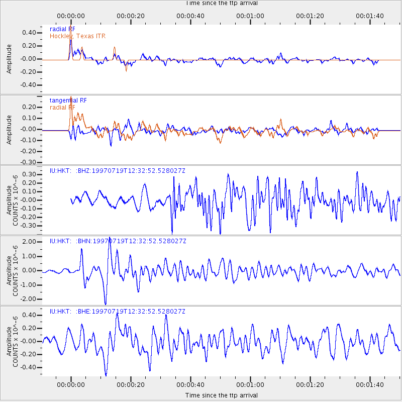
Signal To Noise
| Channel | StoN | STA | LTA |
| IU:HKT: :BHN:19970719T12:32:52.528027Z | 9.633346 | 5.806777E-7 | 6.027789E-8 |
| IU:HKT: :BHE:19970719T12:32:52.528027Z | 1.7998744 | 1.4127009E-7 | 7.848885E-8 |
| IU:HKT: :BHZ:19970719T12:32:52.528027Z | 1.9280936 | 1.21994E-7 | 6.327183E-8 |
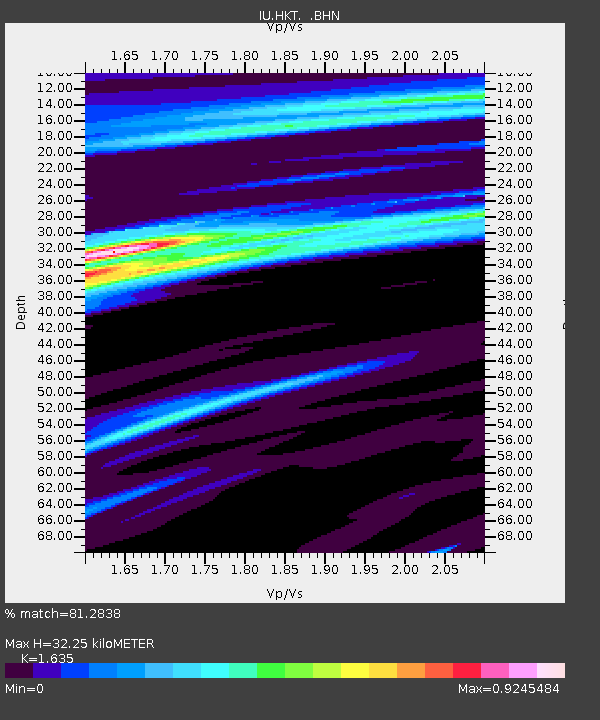
| Arrivals | |
| Ps | 3.8 SECOND |
| PpPs | 15 SECOND |
| PsPs/PpSs | 18 SECOND |

