
HKT Hockley, Texas - Earthquake Result Viewer
| ||||||||||||||||||
| ||||||||||||||||||
| ||||||||||||||||||
|
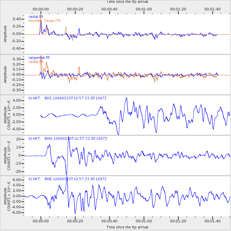
Signal To Noise
| Channel | StoN | STA | LTA |
| IU:HKT: :BHN:19990320T10:57:33.851997Z | 18.786467 | 5.2590412E-6 | 2.7993775E-7 |
| IU:HKT: :BHE:19990320T10:57:33.851997Z | 4.9203715 | 1.2081356E-6 | 2.4553748E-7 |
| IU:HKT: :BHZ:19990320T10:57:33.851997Z | 3.055357 | 9.4800106E-7 | 3.1027506E-7 |
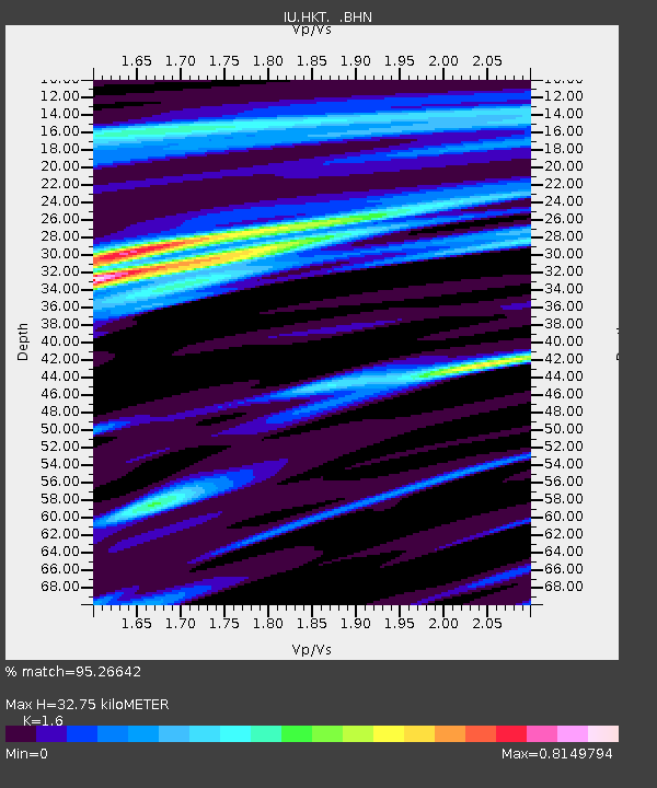
| Arrivals | |
| Ps | 3.7 SECOND |
| PpPs | 15 SECOND |
| PsPs/PpSs | 18 SECOND |

