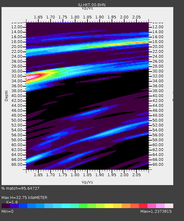
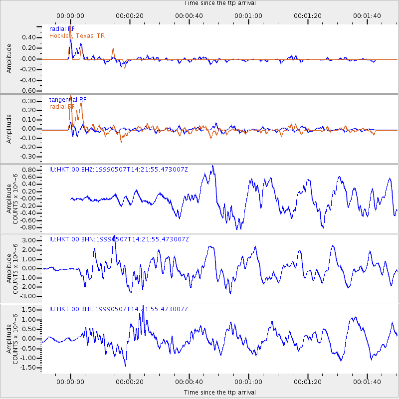
HKT Hockley, Texas - Earthquake Result Viewer

Earthquake location: Kodiak Island Region, Alaska
Earthquake latitude/longitude: 56.4/-152.9
Earthquake time(UTC): 1999/05/07 (127) 14:13:52 GMT
Earthquake Depth: 20 km
Earthquake Magnitude: 5.7 MB, 6.1 MS, 6.4 MW, 5.7 ME
Earthquake Catalog/Contributor: WHDF/NEIC
Network: IU Global Seismograph Network (GSN - IRIS/USGS)
Station: HKT Hockley, Texas
Lat/Lon: 29.96 N/95.84 W
Elevation: -413.0 m
Distance: 47.5 deg
Az: 99.024 deg
Baz: 320.767 deg
Ray Param: 0.069896616
Estimated Moho Depth: 32.75 km
Estimated Crust Vp/Vs: 1.60
Assumed Crust Vp: 5.581 km/s
Estimated Crust Vs: 3.488 km/s
Estimated Crust Poisson's Ratio: 0.18
Radial Match: 95.64727 %
Radial Bump: 342
Transverse Match: 67.438896 %
Transverse Bump: 400
SOD ConfigId: 4480
Insert Time: 2010-03-02 13:55:40.693 +0000
GWidth: 2.5
Max Bumps: 400
Tol: 0.001

Signal To Noise

ChannelStoNSTALTA
IU:HKT:00:BHN:19990507T14:21:55.473007Z7.00481135.5324364E-77.898053E-8
IU:HKT:00:BHE:19990507T14:21:55.473007Z1.93670941.5230532E-77.8641285E-8
IU:HKT:00:BHZ:19990507T14:21:55.473007Z1.63169651.2629648E-77.740195E-8
Arrivals
Ps3.7 SECOND
PpPs15 SECOND
PsPs/PpSs18 SECOND