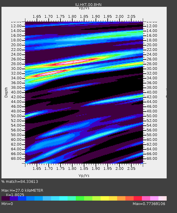
HKT Hockley, Texas - Earthquake Result Viewer
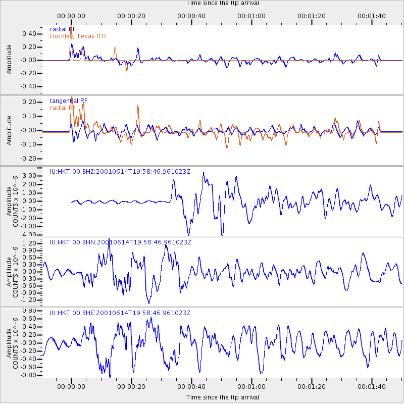
Earthquake location: Andreanof Islands, Aleutian Is.
Earthquake latitude/longitude: 51.2/-179.8
Earthquake time(UTC): 2001/06/14 (165) 19:48:47 GMT
Earthquake Depth: 18 km
Earthquake Magnitude: 6.0 MB, 6.3 MS, 6.5 MW, 6.1 ML
Earthquake Catalog/Contributor: WHDF/NEIC
Network: IU Global Seismograph Network (GSN - IRIS/USGS)
Station: HKT Hockley, Texas
Lat/Lon: 29.96 N/95.84 W
Elevation: -413.0 m
Distance: 63.7 deg
Az: 74.317 deg
Baz: 315.684 deg
Ray Param: 0.059396658
Estimated Moho Depth: 27.0 km
Estimated Crust Vp/Vs: 1.80
Assumed Crust Vp: 5.581 km/s
Estimated Crust Vs: 3.097 km/s
Estimated Crust Poisson's Ratio: 0.28
Radial Match: 84.33613 %
Radial Bump: 400
Transverse Match: 80.72081 %
Transverse Bump: 400
SOD ConfigId: 4714
Insert Time: 2010-03-02 13:56:11.303 +0000
GWidth: 2.5
Max Bumps: 400
Tol: 0.001

Signal To Noise

ChannelStoNSTALTA
IU:HKT:00:BHN:20010614T19:58:46.961023Z0.86431811.8844722E-72.1802994E-7
IU:HKT:00:BHE:20010614T19:58:46.961023Z0.97819151.5283447E-71.5624188E-7
IU:HKT:00:BHZ:20010614T19:58:46.961023Z8.1802339.80942E-71.1991614E-7
Arrivals
Ps4.0 SECOND
PpPs13 SECOND
PsPs/PpSs17 SECOND