You are here: Home > Network List > TA - USArray Transportable Network (new EarthScope stations) Stations List
> Station Z41A Richland Creek Farm, El Dorado, AR, USA > Earthquake Result Viewer
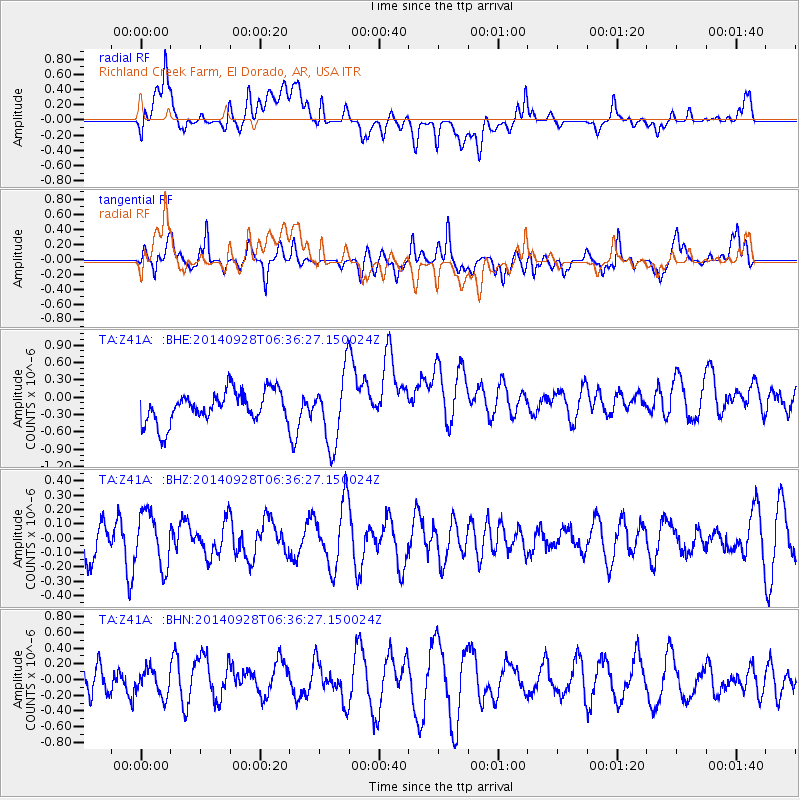
Z41A Richland Creek Farm, El Dorado, AR, USA - Earthquake Result Viewer
*The percent match for this event was below the threshold and hence no stack was calculated.
| Earthquake location: |
Fiji Islands Region |
| Earthquake latitude/longitude: |
-19.1/-176.3 |
| Earthquake time(UTC): |
2014/09/28 (271) 06:23:35 GMT |
| Earthquake Depth: |
10 km |
| Earthquake Magnitude: |
5.7 MWC, 5.7 MWC |
| Earthquake Catalog/Contributor: |
NEIC PDE/NEIC COMCAT |
|
| Network: |
TA USArray Transportable Network (new EarthScope stations) |
| Station: |
Z41A Richland Creek Farm, El Dorado, AR, USA |
| Lat/Lon: |
33.26 N/92.80 W |
| Elevation: |
62 m |
|
| Distance: |
95.1 deg |
| Az: |
56.707 deg |
| Baz: |
250.589 deg |
| Ray Param: |
$rayparam |
*The percent match for this event was below the threshold and hence was not used in the summary stack. |
|
| Radial Match: |
35.879856 % |
| Radial Bump: |
400 |
| Transverse Match: |
67.58129 % |
| Transverse Bump: |
400 |
| SOD ConfigId: |
811408 |
| Insert Time: |
2014-11-07 08:36:31.662 +0000 |
| GWidth: |
2.5 |
| Max Bumps: |
400 |
| Tol: |
0.001 |
|
Signal To Noise
| Channel | StoN | STA | LTA |
| TA:Z41A: :BHZ:20140928T06:36:27.150024Z | 1.3119718 | 1.8591686E-7 | 1.4170797E-7 |
| TA:Z41A: :BHN:20140928T06:36:27.150024Z | 1.0933309 | 1.6261481E-7 | 1.4873339E-7 |
| TA:Z41A: :BHE:20140928T06:36:27.150024Z | 2.2031264 | 6.0281513E-7 | 2.7361804E-7 |
| Arrivals |
| Ps | |
| PpPs | |
| PsPs/PpSs | |


