You are here: Home > Network List > US - United States National Seismic Network Stations List
> Station EGMT Eagleton, Montana, USA > Earthquake Result Viewer
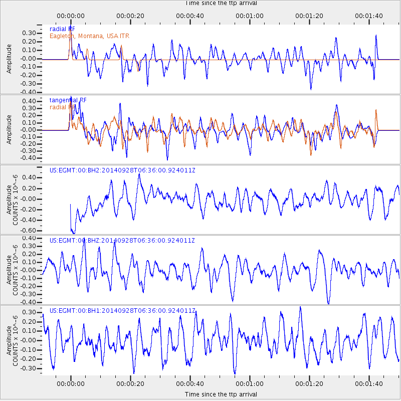
EGMT Eagleton, Montana, USA - Earthquake Result Viewer
*The percent match for this event was below the threshold and hence no stack was calculated.
| Earthquake location: |
Fiji Islands Region |
| Earthquake latitude/longitude: |
-19.1/-176.3 |
| Earthquake time(UTC): |
2014/09/28 (271) 06:23:35 GMT |
| Earthquake Depth: |
10 km |
| Earthquake Magnitude: |
5.7 MWC, 5.7 MWC |
| Earthquake Catalog/Contributor: |
NEIC PDE/NEIC COMCAT |
|
| Network: |
US United States National Seismic Network |
| Station: |
EGMT Eagleton, Montana, USA |
| Lat/Lon: |
48.02 N/109.75 W |
| Elevation: |
1055 m |
|
| Distance: |
89.4 deg |
| Az: |
38.03 deg |
| Baz: |
240.188 deg |
| Ray Param: |
$rayparam |
*The percent match for this event was below the threshold and hence was not used in the summary stack. |
|
| Radial Match: |
51.778618 % |
| Radial Bump: |
400 |
| Transverse Match: |
55.5136 % |
| Transverse Bump: |
339 |
| SOD ConfigId: |
811408 |
| Insert Time: |
2014-11-07 08:37:24.356 +0000 |
| GWidth: |
2.5 |
| Max Bumps: |
400 |
| Tol: |
0.001 |
|
Signal To Noise
| Channel | StoN | STA | LTA |
| US:EGMT:00:BHZ:20140928T06:36:00.924011Z | 1.6918222 | 2.2612859E-7 | 1.3365978E-7 |
| US:EGMT:00:BH1:20140928T06:36:00.924011Z | 0.61061007 | 1.3579809E-7 | 2.2239739E-7 |
| US:EGMT:00:BH2:20140928T06:36:00.924011Z | 0.7142719 | 1.7944383E-7 | 2.512262E-7 |
| Arrivals |
| Ps | |
| PpPs | |
| PsPs/PpSs | |


