You are here: Home > Network List > US - United States National Seismic Network Stations List
> Station DUG Dugway, Tooele County, Utah, USA > Earthquake Result Viewer
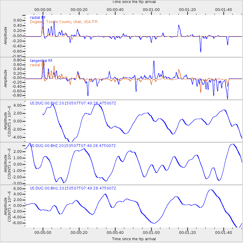
DUG Dugway, Tooele County, Utah, USA - Earthquake Result Viewer
*The percent match for this event was below the threshold and hence no stack was calculated.
| Earthquake location: |
Solomon Islands |
| Earthquake latitude/longitude: |
-7.4/154.8 |
| Earthquake time(UTC): |
2015/05/07 (127) 07:36:33 GMT |
| Earthquake Depth: |
31 km |
| Earthquake Magnitude: |
5.0 mb |
| Earthquake Catalog/Contributor: |
ISC/ISC |
|
| Network: |
US United States National Seismic Network |
| Station: |
DUG Dugway, Tooele County, Utah, USA |
| Lat/Lon: |
40.19 N/112.81 W |
| Elevation: |
1477 m |
|
| Distance: |
96.6 deg |
| Az: |
50.388 deg |
| Baz: |
265.858 deg |
| Ray Param: |
$rayparam |
*The percent match for this event was below the threshold and hence was not used in the summary stack. |
|
| Radial Match: |
49.676098 % |
| Radial Bump: |
209 |
| Transverse Match: |
78.65132 % |
| Transverse Bump: |
241 |
| SOD ConfigId: |
7422571 |
| Insert Time: |
2019-04-18 17:32:37.810 +0000 |
| GWidth: |
2.5 |
| Max Bumps: |
400 |
| Tol: |
0.001 |
|
Signal To Noise
| Channel | StoN | STA | LTA |
| US:DUG:00:BHZ:20150507T07:49:28.475007Z | 0.55887187 | 9.820669E-7 | 1.757231E-6 |
| US:DUG:00:BH1:20150507T07:49:28.475007Z | 1.5017544 | 1.7837E-6 | 1.1877441E-6 |
| US:DUG:00:BH2:20150507T07:49:28.475007Z | 1.2114176 | 3.8810667E-6 | 3.2037397E-6 |
| Arrivals |
| Ps | |
| PpPs | |
| PsPs/PpSs | |


