You are here: Home > Network List > UW - Pacific Northwest Regional Seismic Network Stations List
> Station UMAT Pilot Rock, OR, USA > Earthquake Result Viewer
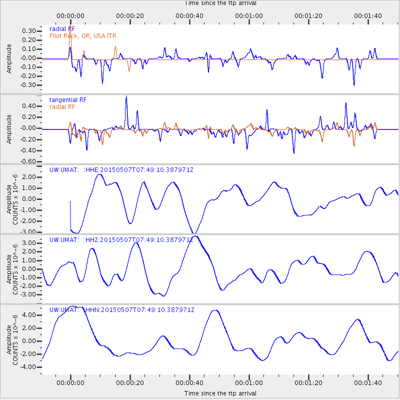
UMAT Pilot Rock, OR, USA - Earthquake Result Viewer
*The percent match for this event was below the threshold and hence no stack was calculated.
| Earthquake location: |
Solomon Islands |
| Earthquake latitude/longitude: |
-7.4/154.8 |
| Earthquake time(UTC): |
2015/05/07 (127) 07:36:33 GMT |
| Earthquake Depth: |
31 km |
| Earthquake Magnitude: |
5.0 mb |
| Earthquake Catalog/Contributor: |
ISC/ISC |
|
| Network: |
UW Pacific Northwest Regional Seismic Network |
| Station: |
UMAT Pilot Rock, OR, USA |
| Lat/Lon: |
45.29 N/118.96 W |
| Elevation: |
1318 m |
|
| Distance: |
92.6 deg |
| Az: |
44.839 deg |
| Baz: |
262.14 deg |
| Ray Param: |
$rayparam |
*The percent match for this event was below the threshold and hence was not used in the summary stack. |
|
| Radial Match: |
46.04288 % |
| Radial Bump: |
180 |
| Transverse Match: |
51.124706 % |
| Transverse Bump: |
299 |
| SOD ConfigId: |
7422571 |
| Insert Time: |
2019-04-18 17:32:57.686 +0000 |
| GWidth: |
2.5 |
| Max Bumps: |
400 |
| Tol: |
0.001 |
|
Signal To Noise
| Channel | StoN | STA | LTA |
| UW:UMAT: :HHZ:20150507T07:49:10.387971Z | 0.746849 | 9.2794426E-7 | 1.2424791E-6 |
| UW:UMAT: :HHN:20150507T07:49:10.387971Z | 2.5398414 | 7.1956097E-6 | 2.833094E-6 |
| UW:UMAT: :HHE:20150507T07:49:10.387971Z | 0.61976427 | 1.0972004E-6 | 1.7703512E-6 |
| Arrivals |
| Ps | |
| PpPs | |
| PsPs/PpSs | |


