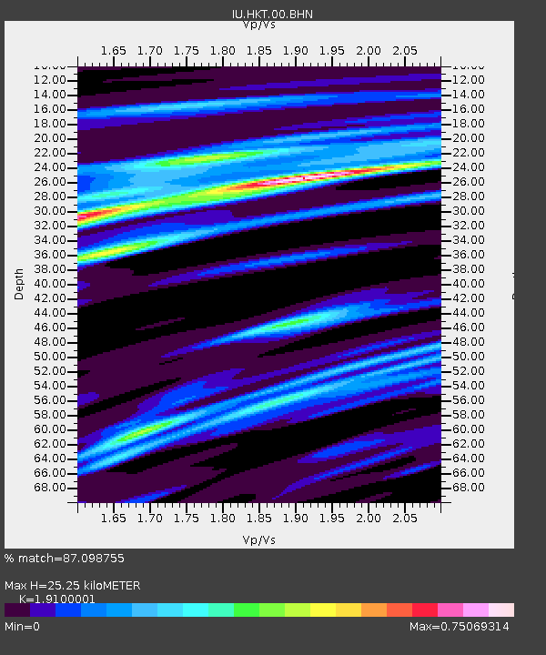
HKT Hockley, Texas - Earthquake Result Viewer
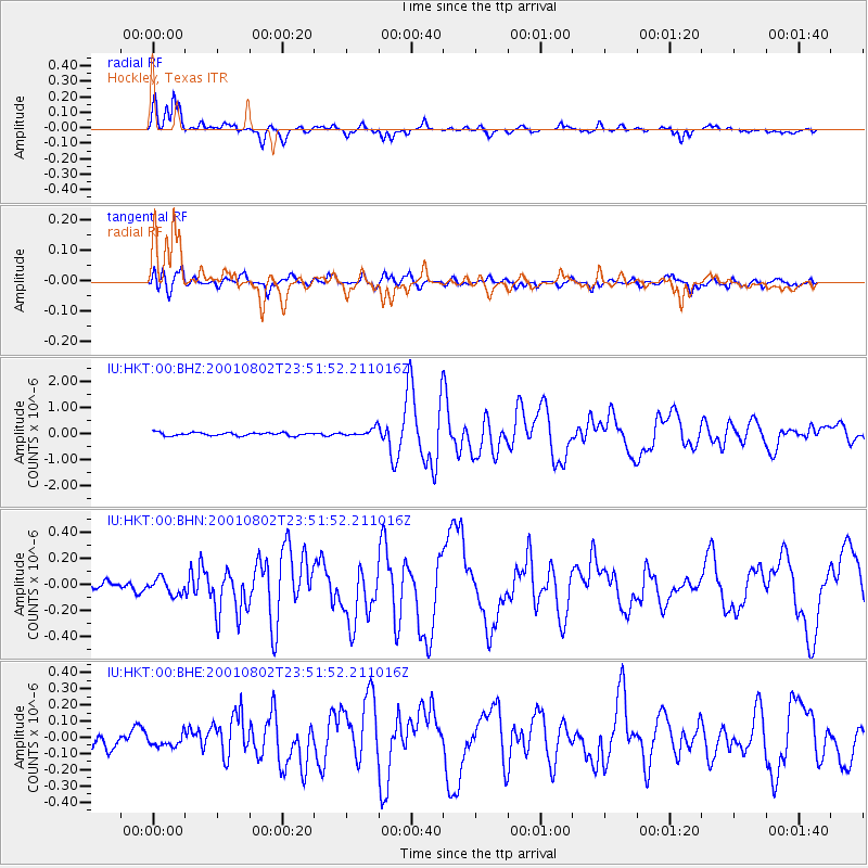
Earthquake location: Near East Coast Of Kamchatka
Earthquake latitude/longitude: 56.3/163.8
Earthquake time(UTC): 2001/08/02 (214) 23:41:06 GMT
Earthquake Depth: 14 km
Earthquake Magnitude: 5.9 MB, 6.2 MS, 6.3 MW, 6.2 ME
Earthquake Catalog/Contributor: WHDF/NEIC
Network: IU Global Seismograph Network (GSN - IRIS/USGS)
Station: HKT Hockley, Texas
Lat/Lon: 29.96 N/95.84 W
Elevation: -413.0 m
Distance: 71.0 deg
Az: 64.513 deg
Baz: 324.519 deg
Ray Param: 0.054586478
Estimated Moho Depth: 25.25 km
Estimated Crust Vp/Vs: 1.91
Assumed Crust Vp: 5.581 km/s
Estimated Crust Vs: 2.922 km/s
Estimated Crust Poisson's Ratio: 0.31
Radial Match: 87.098755 %
Radial Bump: 316
Transverse Match: 78.60406 %
Transverse Bump: 400
SOD ConfigId: 3753
Insert Time: 2010-03-02 13:56:44.978 +0000
GWidth: 2.5
Max Bumps: 400
Tol: 0.001

Signal To Noise

ChannelStoNSTALTA
IU:HKT:00:BHN:20010802T23:51:52.211016Z1.30917275.9574184E-84.5505214E-8
IU:HKT:00:BHE:20010802T23:51:52.211016Z0.72306314.084255E-85.648546E-8
IU:HKT:00:BHZ:20010802T23:51:52.211016Z2.3610871.4850504E-76.289689E-8
Arrivals
Ps4.2 SECOND
PpPs13 SECOND
PsPs/PpSs17 SECOND