You are here: Home > Network List > TA - USArray Transportable Network (new EarthScope stations) Stations List
> Station Z41A Richland Creek Farm, El Dorado, AR, USA > Earthquake Result Viewer
Z41A Richland Creek Farm, El Dorado, AR, USA - Earthquake Result Viewer
*The percent match for this event was below the threshold and hence no stack was calculated.
| Earthquake location: |
Greece |
| Earthquake latitude/longitude: |
38.9/21.2 |
| Earthquake time(UTC): |
2014/10/24 (297) 23:43:15 GMT |
| Earthquake Depth: |
10 km |
| Earthquake Magnitude: |
5.5 MB, 5.2 MWR |
| Earthquake Catalog/Contributor: |
NEIC PDE/NEIC COMCAT |
|
| Network: |
TA USArray Transportable Network (new EarthScope stations) |
| Station: |
Z41A Richland Creek Farm, El Dorado, AR, USA |
| Lat/Lon: |
33.26 N/92.80 W |
| Elevation: |
62 m |
|
| Distance: |
85.6 deg |
| Az: |
309.828 deg |
| Baz: |
45.633 deg |
| Ray Param: |
$rayparam |
*The percent match for this event was below the threshold and hence was not used in the summary stack. |
|
| Radial Match: |
19.254715 % |
| Radial Bump: |
400 |
| Transverse Match: |
26.305527 % |
| Transverse Bump: |
400 |
| SOD ConfigId: |
811962 |
| Insert Time: |
2014-11-08 00:19:37.980 +0000 |
| GWidth: |
2.5 |
| Max Bumps: |
400 |
| Tol: |
0.001 |
|
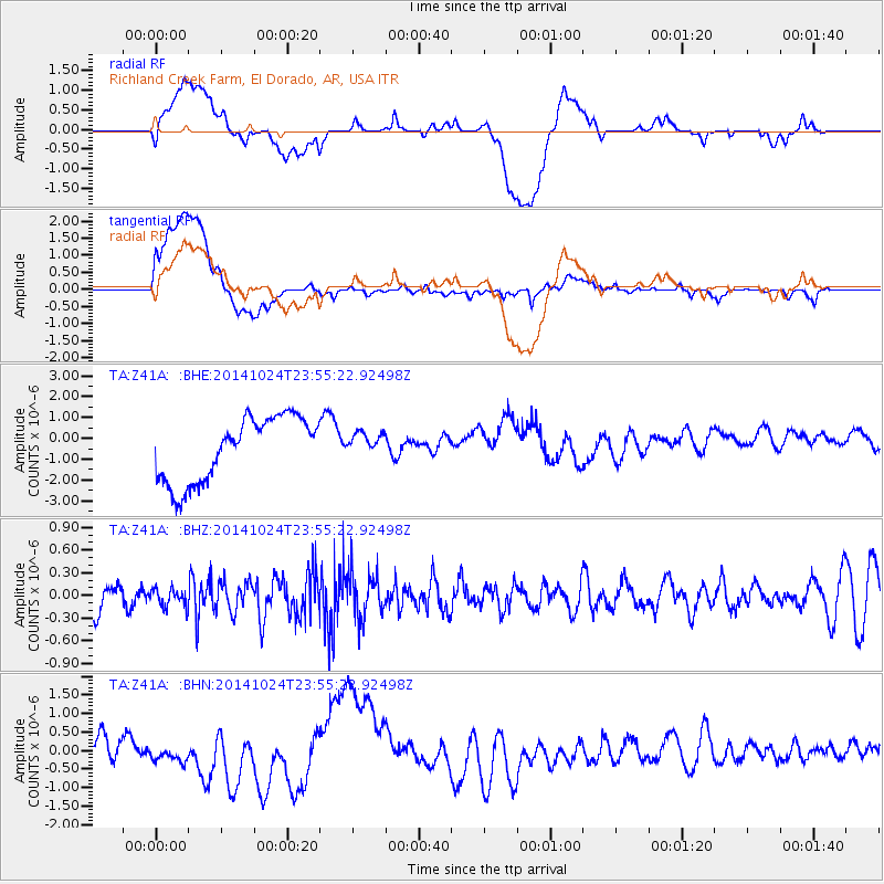
Signal To Noise
| Channel | StoN | STA | LTA |
| TA:Z41A: :BHZ:20141024T23:55:22.92498Z | 0.5396507 | 1.2009352E-7 | 2.2253936E-7 |
| TA:Z41A: :BHN:20141024T23:55:22.92498Z | 0.34070733 | 2.470351E-7 | 7.2506543E-7 |
| TA:Z41A: :BHE:20141024T23:55:22.92498Z | 0.35848066 | 5.450824E-7 | 1.5205351E-6 |
| Arrivals |
| Ps | |
| PpPs | |
| PsPs/PpSs | |


