You are here: Home > Network List > TA - USArray Transportable Network (new EarthScope stations) Stations List
> Station G59A Clarenceville, QC, USA > Earthquake Result Viewer
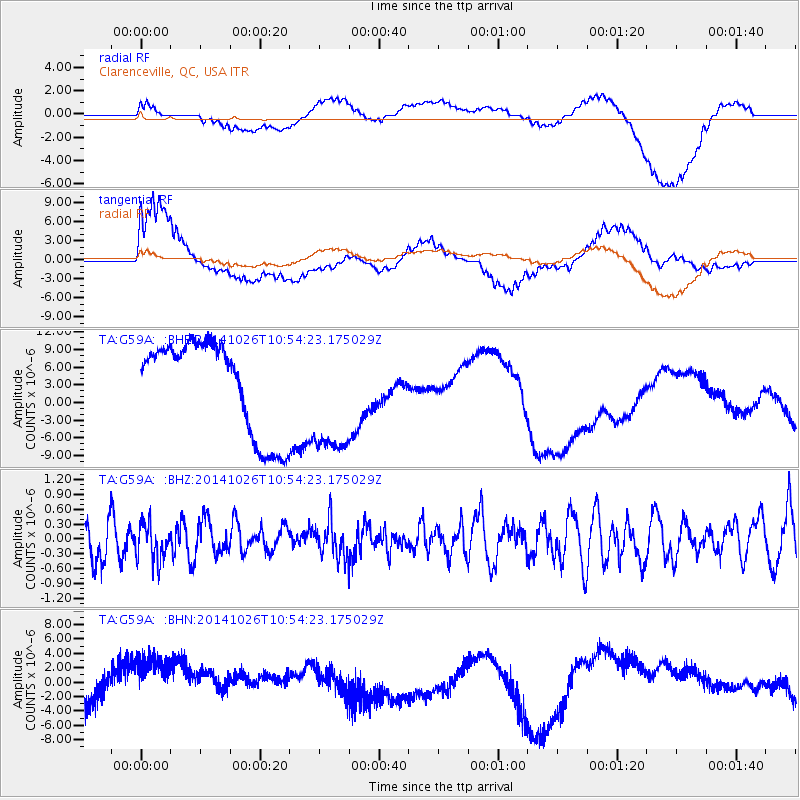
G59A Clarenceville, QC, USA - Earthquake Result Viewer
*The percent match for this event was below the threshold and hence no stack was calculated.
| Earthquake location: |
Central Peru |
| Earthquake latitude/longitude: |
-10.5/-74.1 |
| Earthquake time(UTC): |
2014/10/26 (299) 10:45:32 GMT |
| Earthquake Depth: |
123 km |
| Earthquake Magnitude: |
5.6 MB, 5.7 MWB |
| Earthquake Catalog/Contributor: |
NEIC PDE/NEIC COMCAT |
|
| Network: |
TA USArray Transportable Network (new EarthScope stations) |
| Station: |
G59A Clarenceville, QC, USA |
| Lat/Lon: |
45.08 N/73.18 W |
| Elevation: |
36 m |
|
| Distance: |
55.4 deg |
| Az: |
0.833 deg |
| Baz: |
181.156 deg |
| Ray Param: |
$rayparam |
*The percent match for this event was below the threshold and hence was not used in the summary stack. |
|
| Radial Match: |
72.22403 % |
| Radial Bump: |
400 |
| Transverse Match: |
74.68314 % |
| Transverse Bump: |
400 |
| SOD ConfigId: |
811962 |
| Insert Time: |
2014-11-09 11:22:08.070 +0000 |
| GWidth: |
2.5 |
| Max Bumps: |
400 |
| Tol: |
0.001 |
|
Signal To Noise
| Channel | StoN | STA | LTA |
| TA:G59A: :BHZ:20141026T10:54:23.175029Z | 0.90612537 | 3.693444E-7 | 4.076085E-7 |
| TA:G59A: :BHN:20141026T10:54:23.175029Z | 2.826562 | 5.3522476E-6 | 1.893554E-6 |
| TA:G59A: :BHE:20141026T10:54:23.175029Z | 1.3113133 | 1.0343554E-5 | 7.887936E-6 |
| Arrivals |
| Ps | |
| PpPs | |
| PsPs/PpSs | |


