You are here: Home > Network List > TA - USArray Transportable Network (new EarthScope stations) Stations List
> Station O03E Paynes Creek, CA, USA > Earthquake Result Viewer
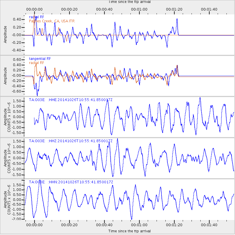
O03E Paynes Creek, CA, USA - Earthquake Result Viewer
*The percent match for this event was below the threshold and hence no stack was calculated.
| Earthquake location: |
Central Peru |
| Earthquake latitude/longitude: |
-10.5/-74.1 |
| Earthquake time(UTC): |
2014/10/26 (299) 10:45:32 GMT |
| Earthquake Depth: |
123 km |
| Earthquake Magnitude: |
5.6 MB, 5.7 MWB |
| Earthquake Catalog/Contributor: |
NEIC PDE/NEIC COMCAT |
|
| Network: |
TA USArray Transportable Network (new EarthScope stations) |
| Station: |
O03E Paynes Creek, CA, USA |
| Lat/Lon: |
40.29 N/121.80 W |
| Elevation: |
967 m |
|
| Distance: |
67.1 deg |
| Az: |
322.138 deg |
| Baz: |
127.901 deg |
| Ray Param: |
$rayparam |
*The percent match for this event was below the threshold and hence was not used in the summary stack. |
|
| Radial Match: |
54.18542 % |
| Radial Bump: |
400 |
| Transverse Match: |
44.622253 % |
| Transverse Bump: |
400 |
| SOD ConfigId: |
811962 |
| Insert Time: |
2014-11-09 11:24:08.862 +0000 |
| GWidth: |
2.5 |
| Max Bumps: |
400 |
| Tol: |
0.001 |
|
Signal To Noise
| Channel | StoN | STA | LTA |
| TA:O03E: :HHZ:20141026T10:55:41.850017Z | 0.8196617 | 5.004638E-7 | 6.1057364E-7 |
| TA:O03E: :HHN:20141026T10:55:41.850017Z | 1.6153232 | 1.3121403E-6 | 8.123082E-7 |
| TA:O03E: :HHE:20141026T10:55:41.850017Z | 1.4065872 | 6.0512843E-7 | 4.302104E-7 |
| Arrivals |
| Ps | |
| PpPs | |
| PsPs/PpSs | |


