You are here: Home > Network List > TA - USArray Transportable Network (new EarthScope stations) Stations List
> Station T25A Trinidad, CO, USA > Earthquake Result Viewer
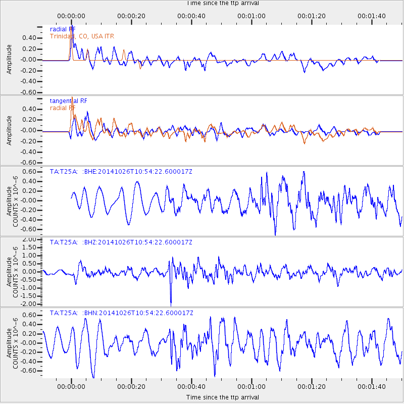
T25A Trinidad, CO, USA - Earthquake Result Viewer
*The percent match for this event was below the threshold and hence no stack was calculated.
| Earthquake location: |
Central Peru |
| Earthquake latitude/longitude: |
-10.5/-74.1 |
| Earthquake time(UTC): |
2014/10/26 (299) 10:45:32 GMT |
| Earthquake Depth: |
123 km |
| Earthquake Magnitude: |
5.6 MB, 5.7 MWB |
| Earthquake Catalog/Contributor: |
NEIC PDE/NEIC COMCAT |
|
| Network: |
TA USArray Transportable Network (new EarthScope stations) |
| Station: |
T25A Trinidad, CO, USA |
| Lat/Lon: |
37.14 N/104.41 W |
| Elevation: |
2017 m |
|
| Distance: |
55.3 deg |
| Az: |
330.667 deg |
| Baz: |
142.928 deg |
| Ray Param: |
$rayparam |
*The percent match for this event was below the threshold and hence was not used in the summary stack. |
|
| Radial Match: |
63.552456 % |
| Radial Bump: |
400 |
| Transverse Match: |
65.30885 % |
| Transverse Bump: |
400 |
| SOD ConfigId: |
811962 |
| Insert Time: |
2014-11-09 11:25:15.658 +0000 |
| GWidth: |
2.5 |
| Max Bumps: |
400 |
| Tol: |
0.001 |
|
Signal To Noise
| Channel | StoN | STA | LTA |
| TA:T25A: :BHZ:20141026T10:54:22.600017Z | 1.9605888 | 3.8219343E-7 | 1.949381E-7 |
| TA:T25A: :BHN:20141026T10:54:22.600017Z | 2.450652 | 3.251362E-7 | 1.3267335E-7 |
| TA:T25A: :BHE:20141026T10:54:22.600017Z | 0.75987655 | 1.7049652E-7 | 2.2437396E-7 |
| Arrivals |
| Ps | |
| PpPs | |
| PsPs/PpSs | |


