You are here: Home > Network List > US - United States National Seismic Network Stations List
> Station EGMT Eagleton, Montana, USA > Earthquake Result Viewer
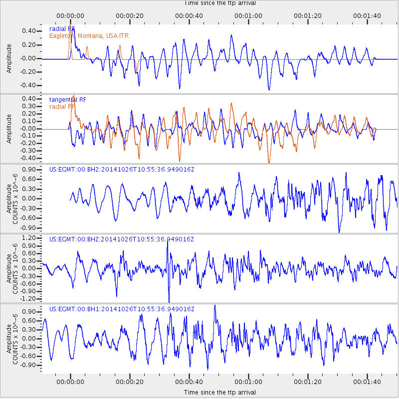
EGMT Eagleton, Montana, USA - Earthquake Result Viewer
*The percent match for this event was below the threshold and hence no stack was calculated.
| Earthquake location: |
Central Peru |
| Earthquake latitude/longitude: |
-10.5/-74.1 |
| Earthquake time(UTC): |
2014/10/26 (299) 10:45:32 GMT |
| Earthquake Depth: |
123 km |
| Earthquake Magnitude: |
5.6 MB, 5.7 MWB |
| Earthquake Catalog/Contributor: |
NEIC PDE/NEIC COMCAT |
|
| Network: |
US United States National Seismic Network |
| Station: |
EGMT Eagleton, Montana, USA |
| Lat/Lon: |
48.02 N/109.75 W |
| Elevation: |
1055 m |
|
| Distance: |
66.3 deg |
| Az: |
334.734 deg |
| Baz: |
141.302 deg |
| Ray Param: |
$rayparam |
*The percent match for this event was below the threshold and hence was not used in the summary stack. |
|
| Radial Match: |
52.102394 % |
| Radial Bump: |
400 |
| Transverse Match: |
71.251076 % |
| Transverse Bump: |
400 |
| SOD ConfigId: |
811962 |
| Insert Time: |
2014-11-09 11:27:27.309 +0000 |
| GWidth: |
2.5 |
| Max Bumps: |
400 |
| Tol: |
0.001 |
|
Signal To Noise
| Channel | StoN | STA | LTA |
| US:EGMT:00:BHZ:20141026T10:55:36.949016Z | 2.5278957 | 3.7885806E-7 | 1.4987091E-7 |
| US:EGMT:00:BH1:20141026T10:55:36.949016Z | 1.1406177 | 4.1122462E-7 | 3.60528E-7 |
| US:EGMT:00:BH2:20141026T10:55:36.949016Z | 1.324141 | 3.5028768E-7 | 2.6453955E-7 |
| Arrivals |
| Ps | |
| PpPs | |
| PsPs/PpSs | |


