You are here: Home > Network List > US - United States National Seismic Network Stations List
> Station MSO Missoula, Montana, USA > Earthquake Result Viewer
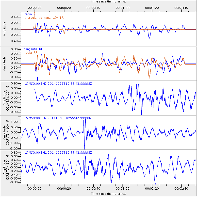
MSO Missoula, Montana, USA - Earthquake Result Viewer
*The percent match for this event was below the threshold and hence no stack was calculated.
| Earthquake location: |
Central Peru |
| Earthquake latitude/longitude: |
-10.5/-74.1 |
| Earthquake time(UTC): |
2014/10/26 (299) 10:45:32 GMT |
| Earthquake Depth: |
123 km |
| Earthquake Magnitude: |
5.6 MB, 5.7 MWB |
| Earthquake Catalog/Contributor: |
NEIC PDE/NEIC COMCAT |
|
| Network: |
US United States National Seismic Network |
| Station: |
MSO Missoula, Montana, USA |
| Lat/Lon: |
46.83 N/113.94 W |
| Elevation: |
1264 m |
|
| Distance: |
67.3 deg |
| Az: |
331.544 deg |
| Baz: |
136.97 deg |
| Ray Param: |
$rayparam |
*The percent match for this event was below the threshold and hence was not used in the summary stack. |
|
| Radial Match: |
57.931313 % |
| Radial Bump: |
400 |
| Transverse Match: |
55.11827 % |
| Transverse Bump: |
400 |
| SOD ConfigId: |
811962 |
| Insert Time: |
2014-11-09 11:27:58.982 +0000 |
| GWidth: |
2.5 |
| Max Bumps: |
400 |
| Tol: |
0.001 |
|
Signal To Noise
| Channel | StoN | STA | LTA |
| US:MSO:00:BHZ:20141026T10:55:42.99998Z | 2.6857831 | 5.917916E-7 | 2.203423E-7 |
| US:MSO:00:BH1:20141026T10:55:42.99998Z | 0.6569689 | 1.4428025E-7 | 2.1961503E-7 |
| US:MSO:00:BH2:20141026T10:55:42.99998Z | 0.6903727 | 1.504898E-7 | 2.1798341E-7 |
| Arrivals |
| Ps | |
| PpPs | |
| PsPs/PpSs | |


