You are here: Home > Network List > UW - Pacific Northwest Regional Seismic Network Stations List
> Station HOOD Mt Hood Meadows, OR CREST BB SMO > Earthquake Result Viewer
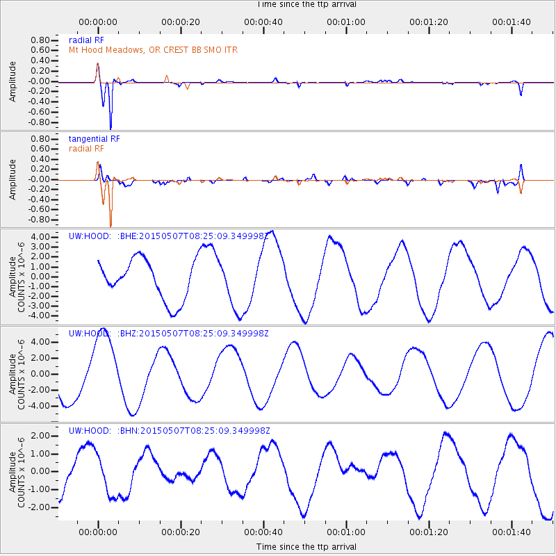
HOOD Mt Hood Meadows, OR CREST BB SMO - Earthquake Result Viewer
*The percent match for this event was below the threshold and hence no stack was calculated.
| Earthquake location: |
Solomon Islands |
| Earthquake latitude/longitude: |
-7.2/154.6 |
| Earthquake time(UTC): |
2015/05/07 (127) 08:12:41 GMT |
| Earthquake Depth: |
39 km |
| Earthquake Magnitude: |
5.0 mb |
| Earthquake Catalog/Contributor: |
ISC/ISC |
|
| Network: |
UW Pacific Northwest Regional Seismic Network |
| Station: |
HOOD Mt Hood Meadows, OR CREST BB SMO |
| Lat/Lon: |
45.32 N/121.65 W |
| Elevation: |
1520 m |
|
| Distance: |
90.7 deg |
| Az: |
44.542 deg |
| Baz: |
260.562 deg |
| Ray Param: |
$rayparam |
*The percent match for this event was below the threshold and hence was not used in the summary stack. |
|
| Radial Match: |
92.97473 % |
| Radial Bump: |
281 |
| Transverse Match: |
69.037094 % |
| Transverse Bump: |
400 |
| SOD ConfigId: |
7422571 |
| Insert Time: |
2019-04-18 17:41:21.667 +0000 |
| GWidth: |
2.5 |
| Max Bumps: |
400 |
| Tol: |
0.001 |
|
Signal To Noise
| Channel | StoN | STA | LTA |
| UW:HOOD: :BHZ:20150507T08:25:09.349998Z | 2.0080457 | 4.8089037E-6 | 2.394818E-6 |
| UW:HOOD: :BHN:20150507T08:25:09.349998Z | 0.75498533 | 1.125774E-6 | 1.4911204E-6 |
| UW:HOOD: :BHE:20150507T08:25:09.349998Z | 1.279675 | 2.5821391E-6 | 2.0178084E-6 |
| Arrivals |
| Ps | |
| PpPs | |
| PsPs/PpSs | |


