You are here: Home > Network List > CN - Canadian National Seismograph Network Stations List
> Station INK INUVIK, NT > Earthquake Result Viewer
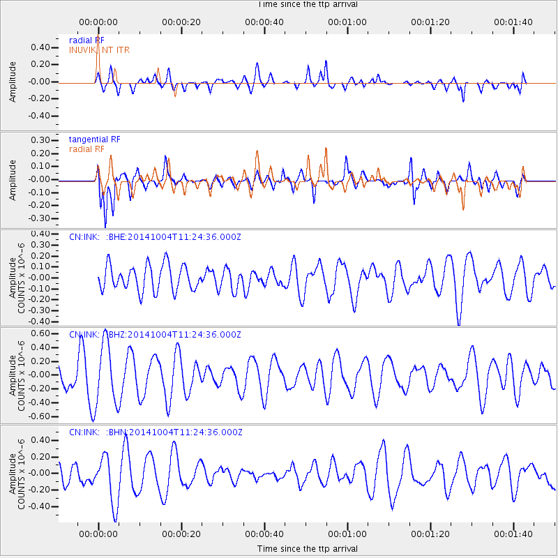
INK INUVIK, NT - Earthquake Result Viewer
*The percent match for this event was below the threshold and hence no stack was calculated.
| Earthquake location: |
Virgin Islands |
| Earthquake latitude/longitude: |
19.2/-64.9 |
| Earthquake time(UTC): |
2014/10/04 (277) 11:14:33 GMT |
| Earthquake Depth: |
29 km |
| Earthquake Magnitude: |
5.5 MWW, 3.0 MD, 3.0 MD, 5.5 MWB, 5.6 MWC |
| Earthquake Catalog/Contributor: |
NEIC PDE/NEIC COMCAT |
|
| Network: |
CN Canadian National Seismograph Network |
| Station: |
INK INUVIK, NT |
| Lat/Lon: |
68.31 N/133.53 W |
| Elevation: |
44 m |
|
| Distance: |
64.4 deg |
| Az: |
337.42 deg |
| Baz: |
102.633 deg |
| Ray Param: |
$rayparam |
*The percent match for this event was below the threshold and hence was not used in the summary stack. |
|
| Radial Match: |
66.29461 % |
| Radial Bump: |
400 |
| Transverse Match: |
74.08703 % |
| Transverse Bump: |
400 |
| SOD ConfigId: |
811962 |
| Insert Time: |
2014-11-10 18:30:22.073 +0000 |
| GWidth: |
2.5 |
| Max Bumps: |
400 |
| Tol: |
0.001 |
|
Signal To Noise
| Channel | StoN | STA | LTA |
| CN:INK: :BHZ:20141004T11:24:36.000Z | 2.5200791 | 4.4787447E-7 | 1.7772238E-7 |
| CN:INK: :BHN:20141004T11:24:36.000Z | 2.6352434 | 3.0237436E-7 | 1.1474248E-7 |
| CN:INK: :BHE:20141004T11:24:36.000Z | 0.86343914 | 9.891159E-8 | 1.1455537E-7 |
| Arrivals |
| Ps | |
| PpPs | |
| PsPs/PpSs | |


