You are here: Home > Network List > CI - Caltech Regional Seismic Network Stations List
> Station DAN Danby, California, USA > Earthquake Result Viewer
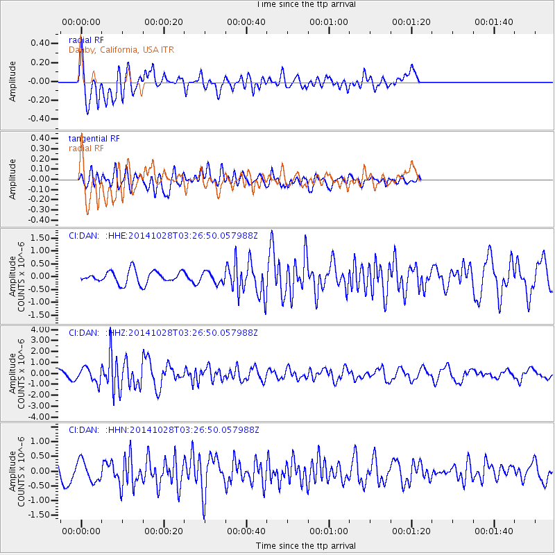
DAN Danby, California, USA - Earthquake Result Viewer
*The percent match for this event was below the threshold and hence no stack was calculated.
| Earthquake location: |
Tonga Islands |
| Earthquake latitude/longitude: |
-15.2/-174.7 |
| Earthquake time(UTC): |
2014/10/28 (301) 03:15:43 GMT |
| Earthquake Depth: |
35 km |
| Earthquake Magnitude: |
5.5 MB, 6.1 MWC |
| Earthquake Catalog/Contributor: |
NEIC PDE/NEIC COMCAT |
|
| Network: |
CI Caltech Regional Seismic Network |
| Station: |
DAN Danby, California, USA |
| Lat/Lon: |
34.64 N/115.38 W |
| Elevation: |
398 m |
|
| Distance: |
75.0 deg |
| Az: |
47.221 deg |
| Baz: |
239.254 deg |
| Ray Param: |
$rayparam |
*The percent match for this event was below the threshold and hence was not used in the summary stack. |
|
| Radial Match: |
66.67847 % |
| Radial Bump: |
400 |
| Transverse Match: |
55.801888 % |
| Transverse Bump: |
400 |
| SOD ConfigId: |
811962 |
| Insert Time: |
2014-11-11 03:39:02.231 +0000 |
| GWidth: |
2.5 |
| Max Bumps: |
400 |
| Tol: |
0.001 |
|
Signal To Noise
| Channel | StoN | STA | LTA |
| CI:DAN: :HHZ:20141028T03:26:50.057988Z | 3.305094 | 6.7544033E-7 | 2.0436342E-7 |
| CI:DAN: :HHN:20141028T03:26:50.057988Z | 1.2173501 | 3.6338963E-7 | 2.9850872E-7 |
| CI:DAN: :HHE:20141028T03:26:50.057988Z | 0.8741748 | 2.1144395E-7 | 2.4187833E-7 |
| Arrivals |
| Ps | |
| PpPs | |
| PsPs/PpSs | |


