You are here: Home > Network List > TA - USArray Transportable Network (new EarthScope stations) Stations List
> Station I23K Minto, Yukon-Koyukuk, AK, USA > Earthquake Result Viewer
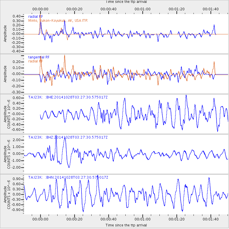
I23K Minto, Yukon-Koyukuk, AK, USA - Earthquake Result Viewer
*The percent match for this event was below the threshold and hence no stack was calculated.
| Earthquake location: |
Tonga Islands |
| Earthquake latitude/longitude: |
-15.2/-174.7 |
| Earthquake time(UTC): |
2014/10/28 (301) 03:15:43 GMT |
| Earthquake Depth: |
35 km |
| Earthquake Magnitude: |
5.5 MB, 6.1 MWC |
| Earthquake Catalog/Contributor: |
NEIC PDE/NEIC COMCAT |
|
| Network: |
TA USArray Transportable Network (new EarthScope stations) |
| Station: |
I23K Minto, Yukon-Koyukuk, AK, USA |
| Lat/Lon: |
65.15 N/149.36 W |
| Elevation: |
149 m |
|
| Distance: |
82.4 deg |
| Az: |
10.501 deg |
| Baz: |
204.606 deg |
| Ray Param: |
$rayparam |
*The percent match for this event was below the threshold and hence was not used in the summary stack. |
|
| Radial Match: |
72.63793 % |
| Radial Bump: |
400 |
| Transverse Match: |
79.67071 % |
| Transverse Bump: |
400 |
| SOD ConfigId: |
811962 |
| Insert Time: |
2014-11-11 03:56:59.043 +0000 |
| GWidth: |
2.5 |
| Max Bumps: |
400 |
| Tol: |
0.001 |
|
Signal To Noise
| Channel | StoN | STA | LTA |
| TA:I23K: :BHZ:20141028T03:27:30.575017Z | 2.9150956 | 4.1680283E-7 | 1.4298084E-7 |
| TA:I23K: :BHN:20141028T03:27:30.575017Z | 0.6980119 | 1.9893793E-7 | 2.850065E-7 |
| TA:I23K: :BHE:20141028T03:27:30.575017Z | 2.1175249 | 2.4992625E-7 | 1.18027536E-7 |
| Arrivals |
| Ps | |
| PpPs | |
| PsPs/PpSs | |


