You are here: Home > Network List > US - United States National Seismic Network Stations List
> Station DGMT Dagmar, Montana, USA > Earthquake Result Viewer
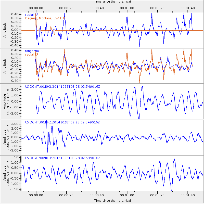
DGMT Dagmar, Montana, USA - Earthquake Result Viewer
*The percent match for this event was below the threshold and hence no stack was calculated.
| Earthquake location: |
Tonga Islands |
| Earthquake latitude/longitude: |
-15.2/-174.7 |
| Earthquake time(UTC): |
2014/10/28 (301) 03:15:43 GMT |
| Earthquake Depth: |
35 km |
| Earthquake Magnitude: |
5.5 MB, 6.1 MWC |
| Earthquake Catalog/Contributor: |
NEIC PDE/NEIC COMCAT |
|
| Network: |
US United States National Seismic Network |
| Station: |
DGMT Dagmar, Montana, USA |
| Lat/Lon: |
48.47 N/104.20 W |
| Elevation: |
0.0 m |
|
| Distance: |
88.8 deg |
| Az: |
38.855 deg |
| Baz: |
245.524 deg |
| Ray Param: |
$rayparam |
*The percent match for this event was below the threshold and hence was not used in the summary stack. |
|
| Radial Match: |
71.57414 % |
| Radial Bump: |
400 |
| Transverse Match: |
71.90048 % |
| Transverse Bump: |
400 |
| SOD ConfigId: |
811962 |
| Insert Time: |
2014-11-11 03:57:39.508 +0000 |
| GWidth: |
2.5 |
| Max Bumps: |
400 |
| Tol: |
0.001 |
|
Signal To Noise
| Channel | StoN | STA | LTA |
| US:DGMT:00:BHZ:20141028T03:28:02.549016Z | 2.6297052 | 4.9912484E-7 | 1.8980259E-7 |
| US:DGMT:00:BH1:20141028T03:28:02.549016Z | 0.59305406 | 3.353716E-7 | 5.654992E-7 |
| US:DGMT:00:BH2:20141028T03:28:02.549016Z | 1.2294372 | 1.1533598E-6 | 9.381201E-7 |
| Arrivals |
| Ps | |
| PpPs | |
| PsPs/PpSs | |


