You are here: Home > Network List > IU - Global Seismograph Network (GSN - IRIS/USGS) Stations List
> Station HKT Hockley, Texas > Earthquake Result Viewer
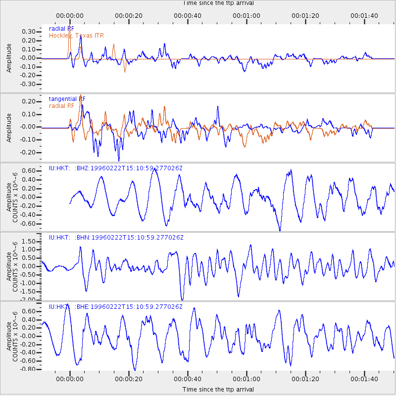
HKT Hockley, Texas - Earthquake Result Viewer
*The percent match for this event was below the threshold and hence no stack was calculated.
| Earthquake location: |
Kuril Islands |
| Earthquake latitude/longitude: |
45.2/148.6 |
| Earthquake time(UTC): |
1996/02/22 (053) 14:59:09 GMT |
| Earthquake Depth: |
133 km |
| Earthquake Magnitude: |
6.2 MB, 6.3 UNKNOWN, 6.3 MW |
| Earthquake Catalog/Contributor: |
WHDF/NEIC |
|
| Network: |
IU Global Seismograph Network (GSN - IRIS/USGS) |
| Station: |
HKT Hockley, Texas |
| Lat/Lon: |
29.96 N/95.84 W |
| Elevation: |
-413.0 m |
|
| Distance: |
85.0 deg |
| Az: |
51.769 deg |
| Baz: |
320.217 deg |
| Ray Param: |
$rayparam |
*The percent match for this event was below the threshold and hence was not used in the summary stack. |
|
| Radial Match: |
60.464405 % |
| Radial Bump: |
400 |
| Transverse Match: |
58.706364 % |
| Transverse Bump: |
354 |
| SOD ConfigId: |
4480 |
| Insert Time: |
2010-03-02 13:59:32.759 +0000 |
| GWidth: |
2.5 |
| Max Bumps: |
400 |
| Tol: |
0.001 |
|
Signal To Noise
| Channel | StoN | STA | LTA |
| IU:HKT: :BHN:19960222T15:10:59.277026Z | 2.864993 | 4.602719E-7 | 1.6065376E-7 |
| IU:HKT: :BHE:19960222T15:10:59.277026Z | 3.0513093 | 5.241033E-7 | 1.7176342E-7 |
| IU:HKT: :BHZ:19960222T15:10:59.277026Z | 1.8791146 | 4.4569873E-7 | 2.371855E-7 |
| Arrivals |
| Ps | |
| PpPs | |
| PsPs/PpSs | |


