You are here: Home > Network List > IU - Global Seismograph Network (GSN - IRIS/USGS) Stations List
> Station HKT Hockley, Texas > Earthquake Result Viewer
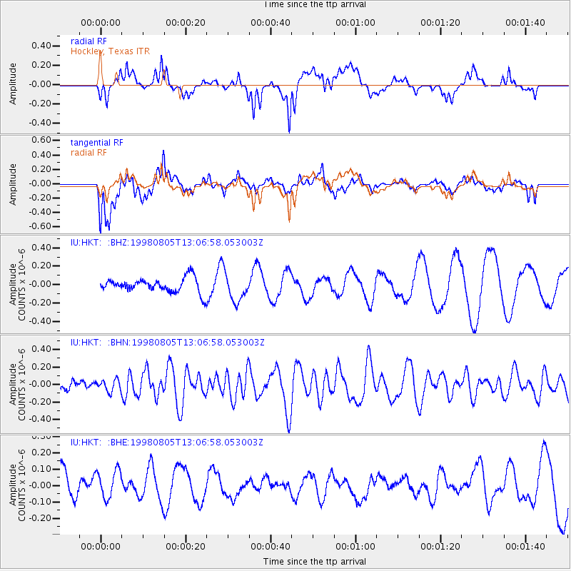
HKT Hockley, Texas - Earthquake Result Viewer
*The percent match for this event was below the threshold and hence no stack was calculated.
| Earthquake location: |
Pacific-Antarctic Ridge |
| Earthquake latitude/longitude: |
-54.7/-135.5 |
| Earthquake time(UTC): |
1998/08/05 (217) 12:54:25 GMT |
| Earthquake Depth: |
10 km |
| Earthquake Magnitude: |
5.9 MS, 5.2 MB, 6.2 UNKNOWN, 6.0 MW |
| Earthquake Catalog/Contributor: |
WHDF/NEIC |
|
| Network: |
IU Global Seismograph Network (GSN - IRIS/USGS) |
| Station: |
HKT Hockley, Texas |
| Lat/Lon: |
29.96 N/95.84 W |
| Elevation: |
-413.0 m |
|
| Distance: |
91.0 deg |
| Az: |
33.656 deg |
| Baz: |
201.772 deg |
| Ray Param: |
$rayparam |
*The percent match for this event was below the threshold and hence was not used in the summary stack. |
|
| Radial Match: |
70.590866 % |
| Radial Bump: |
400 |
| Transverse Match: |
59.883385 % |
| Transverse Bump: |
400 |
| SOD ConfigId: |
4480 |
| Insert Time: |
2010-03-02 13:59:44.198 +0000 |
| GWidth: |
2.5 |
| Max Bumps: |
400 |
| Tol: |
0.001 |
|
Signal To Noise
| Channel | StoN | STA | LTA |
| IU:HKT: :BHN:19980805T13:06:58.053003Z | 1.1270534 | 6.931634E-8 | 6.150227E-8 |
| IU:HKT: :BHE:19980805T13:06:58.053003Z | 1.0827041 | 1.1150572E-7 | 1.0298819E-7 |
| IU:HKT: :BHZ:19980805T13:06:58.053003Z | 1.9160851 | 1.4873119E-7 | 7.762243E-8 |
| Arrivals |
| Ps | |
| PpPs | |
| PsPs/PpSs | |


