You are here: Home > Network List > AV - Alaska Volcano Observatory Stations List
> Station MAPS Pakushin Southeast, Makushin Volcano, Alaska > Earthquake Result Viewer
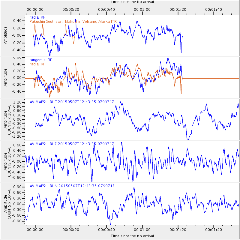
MAPS Pakushin Southeast, Makushin Volcano, Alaska - Earthquake Result Viewer
*The percent match for this event was below the threshold and hence no stack was calculated.
| Earthquake location: |
Talaud Islands, Indonesia |
| Earthquake latitude/longitude: |
4.6/126.5 |
| Earthquake time(UTC): |
2015/05/07 (127) 12:32:50 GMT |
| Earthquake Depth: |
106 km |
| Earthquake Magnitude: |
4.6 mb |
| Earthquake Catalog/Contributor: |
ISC/ISC |
|
| Network: |
AV Alaska Volcano Observatory |
| Station: |
MAPS Pakushin Southeast, Makushin Volcano, Alaska |
| Lat/Lon: |
53.81 N/166.94 W |
| Elevation: |
333 m |
|
| Distance: |
72.6 deg |
| Az: |
34.778 deg |
| Baz: |
253.475 deg |
| Ray Param: |
$rayparam |
*The percent match for this event was below the threshold and hence was not used in the summary stack. |
|
| Radial Match: |
35.55987 % |
| Radial Bump: |
400 |
| Transverse Match: |
71.974884 % |
| Transverse Bump: |
400 |
| SOD ConfigId: |
7422571 |
| Insert Time: |
2019-04-18 17:56:37.419 +0000 |
| GWidth: |
2.5 |
| Max Bumps: |
400 |
| Tol: |
0.001 |
|
Signal To Noise
| Channel | StoN | STA | LTA |
| AV:MAPS: :BHZ:20150507T12:43:35.079971Z | 0.8706431 | 1.9480015E-7 | 2.2374283E-7 |
| AV:MAPS: :BHN:20150507T12:43:35.079971Z | 0.53033066 | 2.816902E-7 | 5.3115957E-7 |
| AV:MAPS: :BHE:20150507T12:43:35.079971Z | 2.7128325 | 8.799974E-7 | 3.2438325E-7 |
| Arrivals |
| Ps | |
| PpPs | |
| PsPs/PpSs | |


