You are here: Home > Network List > TA - USArray Transportable Network (new EarthScope stations) Stations List
> Station Q53A Leroy, WV, USA > Earthquake Result Viewer
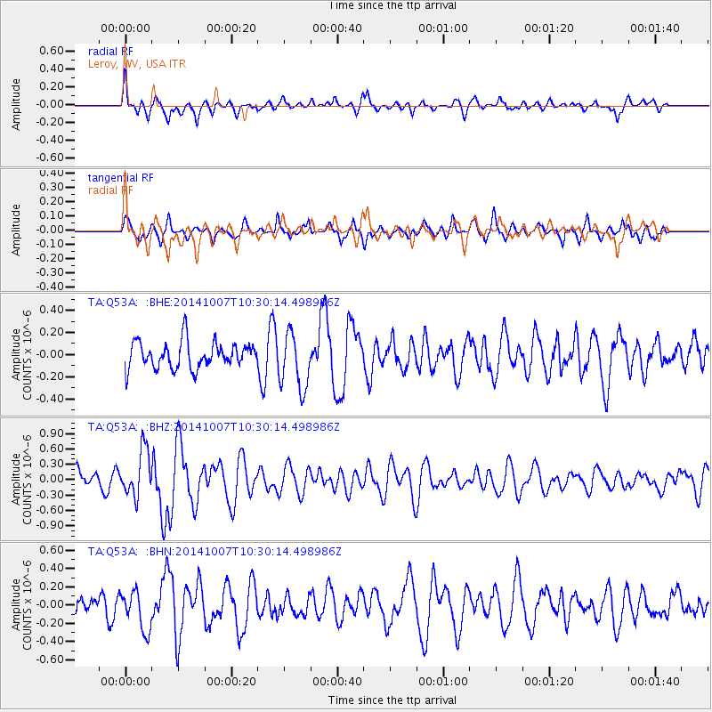
Q53A Leroy, WV, USA - Earthquake Result Viewer
*The percent match for this event was below the threshold and hence no stack was calculated.
| Earthquake location: |
Iceland |
| Earthquake latitude/longitude: |
64.5/-17.2 |
| Earthquake time(UTC): |
2014/10/07 (280) 10:22:31 GMT |
| Earthquake Depth: |
10 km |
| Earthquake Magnitude: |
5.5 MWW, 5.4 MWB, 5.5 MWC |
| Earthquake Catalog/Contributor: |
NEIC PDE/NEIC COMCAT |
|
| Network: |
TA USArray Transportable Network (new EarthScope stations) |
| Station: |
Q53A Leroy, WV, USA |
| Lat/Lon: |
38.86 N/81.53 W |
| Elevation: |
310 m |
|
| Distance: |
44.8 deg |
| Az: |
267.19 deg |
| Baz: |
33.606 deg |
| Ray Param: |
$rayparam |
*The percent match for this event was below the threshold and hence was not used in the summary stack. |
|
| Radial Match: |
77.46134 % |
| Radial Bump: |
400 |
| Transverse Match: |
59.13831 % |
| Transverse Bump: |
400 |
| SOD ConfigId: |
812614 |
| Insert Time: |
2014-11-12 14:08:04.299 +0000 |
| GWidth: |
2.5 |
| Max Bumps: |
400 |
| Tol: |
0.001 |
|
Signal To Noise
| Channel | StoN | STA | LTA |
| TA:Q53A: :BHZ:20141007T10:30:14.498986Z | 2.2868345 | 4.539544E-7 | 1.9850776E-7 |
| TA:Q53A: :BHN:20141007T10:30:14.498986Z | 1.9305191 | 2.1664165E-7 | 1.12219375E-7 |
| TA:Q53A: :BHE:20141007T10:30:14.498986Z | 2.1695657 | 2.571583E-7 | 1.1852985E-7 |
| Arrivals |
| Ps | |
| PpPs | |
| PsPs/PpSs | |


