You are here: Home > Network List > TA - USArray Transportable Network (new EarthScope stations) Stations List
> Station W56A Indian Trail, NC, USA > Earthquake Result Viewer
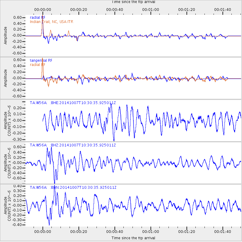
W56A Indian Trail, NC, USA - Earthquake Result Viewer
*The percent match for this event was below the threshold and hence no stack was calculated.
| Earthquake location: |
Iceland |
| Earthquake latitude/longitude: |
64.5/-17.2 |
| Earthquake time(UTC): |
2014/10/07 (280) 10:22:31 GMT |
| Earthquake Depth: |
10 km |
| Earthquake Magnitude: |
5.5 MWW, 5.4 MWB, 5.5 MWC |
| Earthquake Catalog/Contributor: |
NEIC PDE/NEIC COMCAT |
|
| Network: |
TA USArray Transportable Network (new EarthScope stations) |
| Station: |
W56A Indian Trail, NC, USA |
| Lat/Lon: |
35.13 N/80.58 W |
| Elevation: |
177 m |
|
| Distance: |
47.5 deg |
| Az: |
263.531 deg |
| Baz: |
31.635 deg |
| Ray Param: |
$rayparam |
*The percent match for this event was below the threshold and hence was not used in the summary stack. |
|
| Radial Match: |
75.714645 % |
| Radial Bump: |
350 |
| Transverse Match: |
50.76515 % |
| Transverse Bump: |
400 |
| SOD ConfigId: |
812614 |
| Insert Time: |
2014-11-12 14:11:46.158 +0000 |
| GWidth: |
2.5 |
| Max Bumps: |
400 |
| Tol: |
0.001 |
|
Signal To Noise
| Channel | StoN | STA | LTA |
| TA:W56A: :BHZ:20141007T10:30:35.925011Z | 3.9395866 | 3.002802E-7 | 7.622124E-8 |
| TA:W56A: :BHN:20141007T10:30:35.925011Z | 2.7271752 | 1.8443362E-7 | 6.762807E-8 |
| TA:W56A: :BHE:20141007T10:30:35.925011Z | 1.1550391 | 9.8546494E-8 | 8.531875E-8 |
| Arrivals |
| Ps | |
| PpPs | |
| PsPs/PpSs | |


