You are here: Home > Network List > IU - Global Seismograph Network (GSN - IRIS/USGS) Stations List
> Station HKT Hockley, Texas > Earthquake Result Viewer
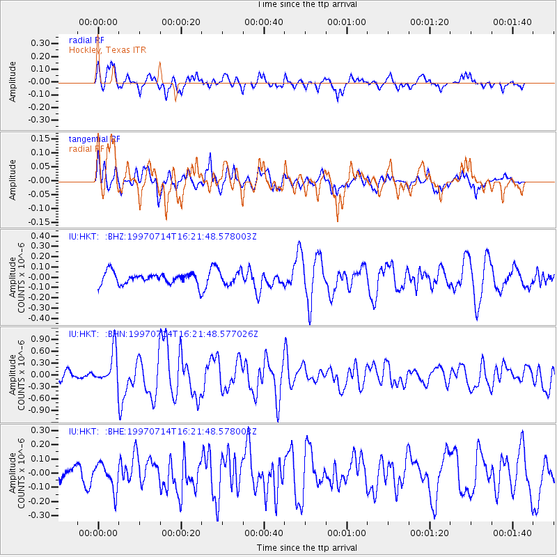
HKT Hockley, Texas - Earthquake Result Viewer
*The percent match for this event was below the threshold and hence no stack was calculated.
| Earthquake location: |
Kuril Islands |
| Earthquake latitude/longitude: |
43.2/146.4 |
| Earthquake time(UTC): |
1997/07/14 (195) 16:09:35 GMT |
| Earthquake Depth: |
33 km |
| Earthquake Magnitude: |
5.9 MB, 5.8 MS, 6.1 UNKNOWN, 5.8 ME |
| Earthquake Catalog/Contributor: |
WHDF/NEIC |
|
| Network: |
IU Global Seismograph Network (GSN - IRIS/USGS) |
| Station: |
HKT Hockley, Texas |
| Lat/Lon: |
29.96 N/95.84 W |
| Elevation: |
-413.0 m |
|
| Distance: |
87.5 deg |
| Az: |
50.221 deg |
| Baz: |
319.679 deg |
| Ray Param: |
$rayparam |
*The percent match for this event was below the threshold and hence was not used in the summary stack. |
|
| Radial Match: |
83.772766 % |
| Radial Bump: |
400 |
| Transverse Match: |
80.01423 % |
| Transverse Bump: |
400 |
| SOD ConfigId: |
4480 |
| Insert Time: |
2010-03-02 14:00:34.336 +0000 |
| GWidth: |
2.5 |
| Max Bumps: |
400 |
| Tol: |
0.001 |
|
Signal To Noise
| Channel | StoN | STA | LTA |
| IU:HKT: :BHN:19970714T16:21:48.577026Z | 5.41528 | 4.2891043E-7 | 7.9203744E-8 |
| IU:HKT: :BHE:19970714T16:21:48.578003Z | 1.7202598 | 9.6047984E-8 | 5.5833418E-8 |
| IU:HKT: :BHZ:19970714T16:21:48.578003Z | 1.1429442 | 6.3212354E-8 | 5.5306593E-8 |
| Arrivals |
| Ps | |
| PpPs | |
| PsPs/PpSs | |


