You are here: Home > Network List > US - United States National Seismic Network Stations List
> Station MIAR Mount Ida, Arkansas, USA > Earthquake Result Viewer
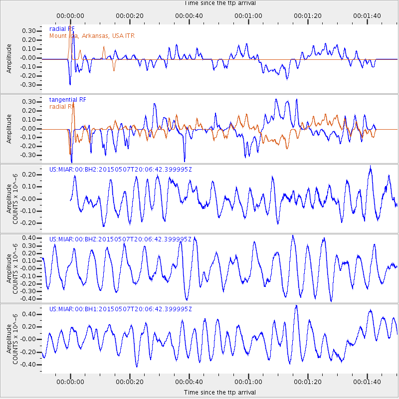
MIAR Mount Ida, Arkansas, USA - Earthquake Result Viewer
*The percent match for this event was below the threshold and hence no stack was calculated.
| Earthquake location: |
Tonga Islands Region |
| Earthquake latitude/longitude: |
-19.3/-172.8 |
| Earthquake time(UTC): |
2015/05/07 (127) 19:54:05 GMT |
| Earthquake Depth: |
21 km |
| Earthquake Magnitude: |
5.2 MW |
| Earthquake Catalog/Contributor: |
ISC/ISC |
|
| Network: |
US United States National Seismic Network |
| Station: |
MIAR Mount Ida, Arkansas, USA |
| Lat/Lon: |
34.55 N/93.58 W |
| Elevation: |
207 m |
|
| Distance: |
92.3 deg |
| Az: |
54.248 deg |
| Baz: |
248.221 deg |
| Ray Param: |
$rayparam |
*The percent match for this event was below the threshold and hence was not used in the summary stack. |
|
| Radial Match: |
35.517746 % |
| Radial Bump: |
400 |
| Transverse Match: |
61.45599 % |
| Transverse Bump: |
400 |
| SOD ConfigId: |
7422571 |
| Insert Time: |
2019-04-18 18:03:45.442 +0000 |
| GWidth: |
2.5 |
| Max Bumps: |
400 |
| Tol: |
0.001 |
|
Signal To Noise
| Channel | StoN | STA | LTA |
| US:MIAR:00:BHZ:20150507T20:06:42.399995Z | 0.848819 | 1.4948094E-7 | 1.761046E-7 |
| US:MIAR:00:BH1:20150507T20:06:42.399995Z | 0.7279454 | 1.17461816E-7 | 1.6136076E-7 |
| US:MIAR:00:BH2:20150507T20:06:42.399995Z | 1.5084652 | 1.5305305E-7 | 1.0146277E-7 |
| Arrivals |
| Ps | |
| PpPs | |
| PsPs/PpSs | |


