You are here: Home > Network List > US - United States National Seismic Network Stations List
> Station DGMT Dagmar, Montana, USA > Earthquake Result Viewer
DGMT Dagmar, Montana, USA - Earthquake Result Viewer
*The percent match for this event was below the threshold and hence no stack was calculated.
| Earthquake location: |
Oaxaca, Mexico |
| Earthquake latitude/longitude: |
16.0/-95.6 |
| Earthquake time(UTC): |
2014/10/11 (284) 16:46:02 GMT |
| Earthquake Depth: |
10 km |
| Earthquake Magnitude: |
5.5 MWW, 5.5 MWC |
| Earthquake Catalog/Contributor: |
NEIC PDE/NEIC COMCAT |
|
| Network: |
US United States National Seismic Network |
| Station: |
DGMT Dagmar, Montana, USA |
| Lat/Lon: |
48.47 N/104.20 W |
| Elevation: |
0.0 m |
|
| Distance: |
33.1 deg |
| Az: |
349.569 deg |
| Baz: |
164.834 deg |
| Ray Param: |
$rayparam |
*The percent match for this event was below the threshold and hence was not used in the summary stack. |
|
| Radial Match: |
27.279968 % |
| Radial Bump: |
276 |
| Transverse Match: |
56.058155 % |
| Transverse Bump: |
375 |
| SOD ConfigId: |
813215 |
| Insert Time: |
2014-11-14 21:38:53.189 +0000 |
| GWidth: |
2.5 |
| Max Bumps: |
400 |
| Tol: |
0.001 |
|
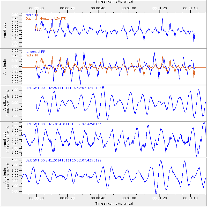
Signal To Noise
| Channel | StoN | STA | LTA |
| US:DGMT:00:BHZ:20141011T16:52:07.425012Z | 2.5186028 | 1.1002357E-6 | 4.368437E-7 |
| US:DGMT:00:BH1:20141011T16:52:07.425012Z | 1.0716693 | 2.011282E-6 | 1.8767748E-6 |
| US:DGMT:00:BH2:20141011T16:52:07.425012Z | 1.0569501 | 1.6492728E-6 | 1.5604074E-6 |
| Arrivals |
| Ps | |
| PpPs | |
| PsPs/PpSs | |


