You are here: Home > Network List > WY - Yellowstone Wyoming Seismic Network Stations List
> Station YHH Holmes Hill, YNP, WY, USA > Earthquake Result Viewer
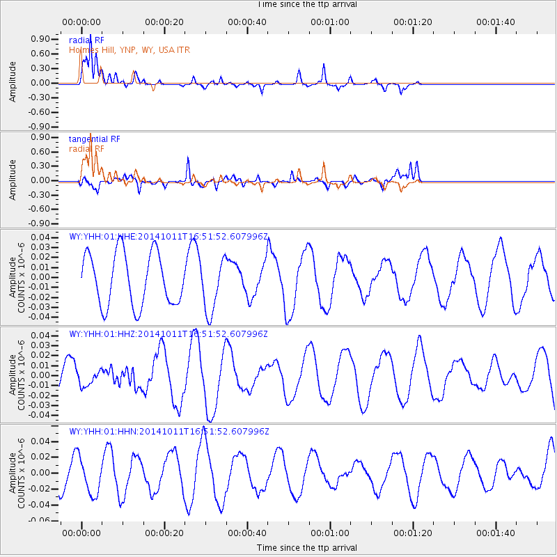
YHH Holmes Hill, YNP, WY, USA - Earthquake Result Viewer
*The percent match for this event was below the threshold and hence no stack was calculated.
| Earthquake location: |
Oaxaca, Mexico |
| Earthquake latitude/longitude: |
16.0/-95.6 |
| Earthquake time(UTC): |
2014/10/11 (284) 16:46:02 GMT |
| Earthquake Depth: |
10 km |
| Earthquake Magnitude: |
5.5 MWW, 5.5 MWC |
| Earthquake Catalog/Contributor: |
NEIC PDE/NEIC COMCAT |
|
| Network: |
WY Yellowstone Wyoming Seismic Network |
| Station: |
YHH Holmes Hill, YNP, WY, USA |
| Lat/Lon: |
44.79 N/110.85 W |
| Elevation: |
2717 m |
|
| Distance: |
31.4 deg |
| Az: |
339.009 deg |
| Baz: |
151.068 deg |
| Ray Param: |
$rayparam |
*The percent match for this event was below the threshold and hence was not used in the summary stack. |
|
| Radial Match: |
93.39543 % |
| Radial Bump: |
362 |
| Transverse Match: |
64.35124 % |
| Transverse Bump: |
400 |
| SOD ConfigId: |
813215 |
| Insert Time: |
2014-11-14 21:40:28.306 +0000 |
| GWidth: |
2.5 |
| Max Bumps: |
400 |
| Tol: |
0.001 |
|
Signal To Noise
| Channel | StoN | STA | LTA |
| WY:YHH:01:HHZ:20141011T16:51:52.607996Z | 0.44139126 | 7.3942235E-9 | 1.6752084E-8 |
| WY:YHH:01:HHN:20141011T16:51:52.607996Z | 1.3569968 | 2.346816E-8 | 1.7294191E-8 |
| WY:YHH:01:HHE:20141011T16:51:52.607996Z | 1.0279485 | 2.6917474E-8 | 2.6185624E-8 |
| Arrivals |
| Ps | |
| PpPs | |
| PsPs/PpSs | |


