You are here: Home > Network List > CN - Canadian National Seismograph Network Stations List
> Station INK INUVIK, NT > Earthquake Result Viewer
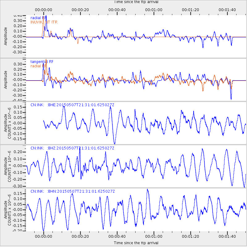
INK INUVIK, NT - Earthquake Result Viewer
*The percent match for this event was below the threshold and hence no stack was calculated.
| Earthquake location: |
New Britain Region, P.N.G. |
| Earthquake latitude/longitude: |
-4.9/152.1 |
| Earthquake time(UTC): |
2015/05/07 (127) 21:18:46 GMT |
| Earthquake Depth: |
69 km |
| Earthquake Magnitude: |
5.2 MW |
| Earthquake Catalog/Contributor: |
ISC/ISC |
|
| Network: |
CN Canadian National Seismograph Network |
| Station: |
INK INUVIK, NT |
| Lat/Lon: |
68.31 N/133.53 W |
| Elevation: |
44 m |
|
| Distance: |
88.8 deg |
| Az: |
20.986 deg |
| Baz: |
253.713 deg |
| Ray Param: |
$rayparam |
*The percent match for this event was below the threshold and hence was not used in the summary stack. |
|
| Radial Match: |
52.70181 % |
| Radial Bump: |
400 |
| Transverse Match: |
53.70478 % |
| Transverse Bump: |
400 |
| SOD ConfigId: |
7422571 |
| Insert Time: |
2019-04-18 18:06:33.232 +0000 |
| GWidth: |
2.5 |
| Max Bumps: |
400 |
| Tol: |
0.001 |
|
Signal To Noise
| Channel | StoN | STA | LTA |
| CN:INK: :BHZ:20150507T21:31:01.625027Z | 2.0327873 | 1.3001579E-7 | 6.395936E-8 |
| CN:INK: :BHN:20150507T21:31:01.625027Z | 1.4337636 | 1.0992459E-7 | 7.6668556E-8 |
| CN:INK: :BHE:20150507T21:31:01.625027Z | 0.9961787 | 5.2221665E-8 | 5.2421985E-8 |
| Arrivals |
| Ps | |
| PpPs | |
| PsPs/PpSs | |


