You are here: Home > Network List > TA - USArray Transportable Network (new EarthScope stations) Stations List
> Station I23K Minto, Yukon-Koyukuk, AK, USA > Earthquake Result Viewer
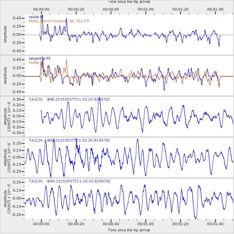
I23K Minto, Yukon-Koyukuk, AK, USA - Earthquake Result Viewer
*The percent match for this event was below the threshold and hence no stack was calculated.
| Earthquake location: |
New Britain Region, P.N.G. |
| Earthquake latitude/longitude: |
-4.9/152.1 |
| Earthquake time(UTC): |
2015/05/07 (127) 21:18:46 GMT |
| Earthquake Depth: |
69 km |
| Earthquake Magnitude: |
5.2 MW |
| Earthquake Catalog/Contributor: |
ISC/ISC |
|
| Network: |
TA USArray Transportable Network (new EarthScope stations) |
| Station: |
I23K Minto, Yukon-Koyukuk, AK, USA |
| Lat/Lon: |
65.15 N/149.36 W |
| Elevation: |
149 m |
|
| Distance: |
81.8 deg |
| Az: |
21.363 deg |
| Baz: |
239.193 deg |
| Ray Param: |
$rayparam |
*The percent match for this event was below the threshold and hence was not used in the summary stack. |
|
| Radial Match: |
59.468967 % |
| Radial Bump: |
400 |
| Transverse Match: |
64.01051 % |
| Transverse Bump: |
400 |
| SOD ConfigId: |
7422571 |
| Insert Time: |
2019-04-18 18:07:53.064 +0000 |
| GWidth: |
2.5 |
| Max Bumps: |
400 |
| Tol: |
0.001 |
|
Signal To Noise
| Channel | StoN | STA | LTA |
| TA:I23K: :BHZ:20150507T21:30:26.824978Z | 1.4884322 | 1.1920692E-7 | 8.0088924E-8 |
| TA:I23K: :BHN:20150507T21:30:26.824978Z | 0.7269195 | 7.920678E-8 | 1.0896225E-7 |
| TA:I23K: :BHE:20150507T21:30:26.824978Z | 1.8953067 | 1.9888326E-7 | 1.0493461E-7 |
| Arrivals |
| Ps | |
| PpPs | |
| PsPs/PpSs | |


