You are here: Home > Network List > TA - USArray Transportable Network (new EarthScope stations) Stations List
> Station N56A West Decatur, PA, USA > Earthquake Result Viewer
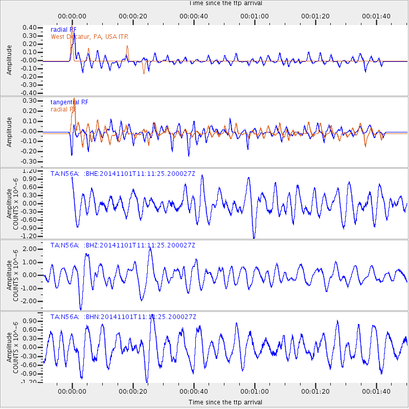
N56A West Decatur, PA, USA - Earthquake Result Viewer
*The percent match for this event was below the threshold and hence no stack was calculated.
| Earthquake location: |
Easter Island Region |
| Earthquake latitude/longitude: |
-31.8/-111.2 |
| Earthquake time(UTC): |
2014/11/01 (305) 10:59:55 GMT |
| Earthquake Depth: |
10 km |
| Earthquake Magnitude: |
6.0 MWP |
| Earthquake Catalog/Contributor: |
NEIC PDE/NEIC COMCAT |
|
| Network: |
TA USArray Transportable Network (new EarthScope stations) |
| Station: |
N56A West Decatur, PA, USA |
| Lat/Lon: |
40.92 N/78.30 W |
| Elevation: |
561 m |
|
| Distance: |
78.5 deg |
| Az: |
24.828 deg |
| Baz: |
208.142 deg |
| Ray Param: |
$rayparam |
*The percent match for this event was below the threshold and hence was not used in the summary stack. |
|
| Radial Match: |
61.357998 % |
| Radial Bump: |
390 |
| Transverse Match: |
64.231445 % |
| Transverse Bump: |
400 |
| SOD ConfigId: |
813215 |
| Insert Time: |
2014-11-15 11:38:07.517 +0000 |
| GWidth: |
2.5 |
| Max Bumps: |
400 |
| Tol: |
0.001 |
|
Signal To Noise
| Channel | StoN | STA | LTA |
| TA:N56A: :BHZ:20141101T11:11:25.200027Z | 2.316405 | 1.2257402E-6 | 5.2915624E-7 |
| TA:N56A: :BHN:20141101T11:11:25.200027Z | 1.6654916 | 5.168644E-7 | 3.1033747E-7 |
| TA:N56A: :BHE:20141101T11:11:25.200027Z | 0.43752944 | 1.4505792E-7 | 3.3153867E-7 |
| Arrivals |
| Ps | |
| PpPs | |
| PsPs/PpSs | |


