You are here: Home > Network List > TA - USArray Transportable Network (new EarthScope stations) Stations List
> Station V57A Coltrane Farms, NC, USA > Earthquake Result Viewer
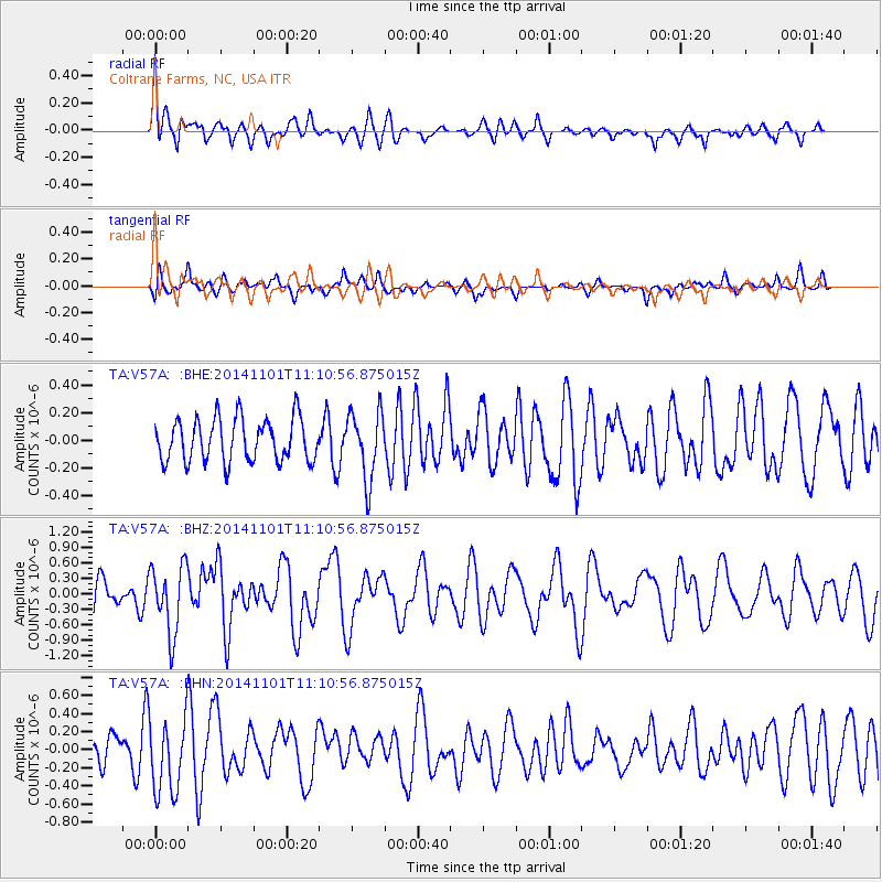
V57A Coltrane Farms, NC, USA - Earthquake Result Viewer
*The percent match for this event was below the threshold and hence no stack was calculated.
| Earthquake location: |
Easter Island Region |
| Earthquake latitude/longitude: |
-31.8/-111.2 |
| Earthquake time(UTC): |
2014/11/01 (305) 10:59:55 GMT |
| Earthquake Depth: |
10 km |
| Earthquake Magnitude: |
6.0 MWP |
| Earthquake Catalog/Contributor: |
NEIC PDE/NEIC COMCAT |
|
| Network: |
TA USArray Transportable Network (new EarthScope stations) |
| Station: |
V57A Coltrane Farms, NC, USA |
| Lat/Lon: |
35.89 N/79.78 W |
| Elevation: |
223 m |
|
| Distance: |
73.5 deg |
| Az: |
26.184 deg |
| Baz: |
207.554 deg |
| Ray Param: |
$rayparam |
*The percent match for this event was below the threshold and hence was not used in the summary stack. |
|
| Radial Match: |
73.39295 % |
| Radial Bump: |
400 |
| Transverse Match: |
60.9169 % |
| Transverse Bump: |
400 |
| SOD ConfigId: |
813215 |
| Insert Time: |
2014-11-15 11:41:30.573 +0000 |
| GWidth: |
2.5 |
| Max Bumps: |
400 |
| Tol: |
0.001 |
|
Signal To Noise
| Channel | StoN | STA | LTA |
| TA:V57A: :BHZ:20141101T11:10:56.875015Z | 2.0399857 | 6.5985546E-7 | 3.2346082E-7 |
| TA:V57A: :BHN:20141101T11:10:56.875015Z | 2.1756477 | 4.129687E-7 | 1.8981412E-7 |
| TA:V57A: :BHE:20141101T11:10:56.875015Z | 1.5781906 | 2.4465865E-7 | 1.550248E-7 |
| Arrivals |
| Ps | |
| PpPs | |
| PsPs/PpSs | |


