You are here: Home > Network List > US - United States National Seismic Network Stations List
> Station HAWA Hanford, Washington, USA > Earthquake Result Viewer
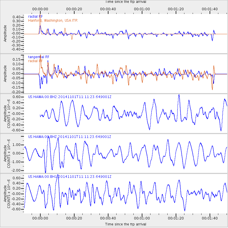
HAWA Hanford, Washington, USA - Earthquake Result Viewer
*The percent match for this event was below the threshold and hence no stack was calculated.
| Earthquake location: |
Easter Island Region |
| Earthquake latitude/longitude: |
-31.8/-111.2 |
| Earthquake time(UTC): |
2014/11/01 (305) 10:59:55 GMT |
| Earthquake Depth: |
10 km |
| Earthquake Magnitude: |
6.0 MWP |
| Earthquake Catalog/Contributor: |
NEIC PDE/NEIC COMCAT |
|
| Network: |
US United States National Seismic Network |
| Station: |
HAWA Hanford, Washington, USA |
| Lat/Lon: |
46.39 N/119.53 W |
| Elevation: |
364 m |
|
| Distance: |
78.2 deg |
| Az: |
354.105 deg |
| Baz: |
172.743 deg |
| Ray Param: |
$rayparam |
*The percent match for this event was below the threshold and hence was not used in the summary stack. |
|
| Radial Match: |
58.45471 % |
| Radial Bump: |
400 |
| Transverse Match: |
80.41378 % |
| Transverse Bump: |
400 |
| SOD ConfigId: |
813215 |
| Insert Time: |
2014-11-15 11:44:18.652 +0000 |
| GWidth: |
2.5 |
| Max Bumps: |
400 |
| Tol: |
0.001 |
|
Signal To Noise
| Channel | StoN | STA | LTA |
| US:HAWA:00:BHZ:20141101T11:11:23.649001Z | 3.0483572 | 1.0303607E-6 | 3.3800526E-7 |
| US:HAWA:00:BH1:20141101T11:11:23.649001Z | 1.1727276 | 2.784856E-7 | 2.374683E-7 |
| US:HAWA:00:BH2:20141101T11:11:23.649001Z | 0.7003496 | 1.7649964E-7 | 2.5201646E-7 |
| Arrivals |
| Ps | |
| PpPs | |
| PsPs/PpSs | |


