You are here: Home > Network List > US - United States National Seismic Network Stations List
> Station MSO Missoula, Montana, USA > Earthquake Result Viewer
MSO Missoula, Montana, USA - Earthquake Result Viewer
*The percent match for this event was below the threshold and hence no stack was calculated.
| Earthquake location: |
Easter Island Region |
| Earthquake latitude/longitude: |
-31.8/-111.2 |
| Earthquake time(UTC): |
2014/11/01 (305) 10:59:55 GMT |
| Earthquake Depth: |
10 km |
| Earthquake Magnitude: |
6.0 MWP |
| Earthquake Catalog/Contributor: |
NEIC PDE/NEIC COMCAT |
|
| Network: |
US United States National Seismic Network |
| Station: |
MSO Missoula, Montana, USA |
| Lat/Lon: |
46.83 N/113.94 W |
| Elevation: |
1264 m |
|
| Distance: |
78.3 deg |
| Az: |
358.065 deg |
| Baz: |
177.6 deg |
| Ray Param: |
$rayparam |
*The percent match for this event was below the threshold and hence was not used in the summary stack. |
|
| Radial Match: |
60.321327 % |
| Radial Bump: |
400 |
| Transverse Match: |
63.160313 % |
| Transverse Bump: |
400 |
| SOD ConfigId: |
813215 |
| Insert Time: |
2014-11-15 11:44:57.794 +0000 |
| GWidth: |
2.5 |
| Max Bumps: |
400 |
| Tol: |
0.001 |
|
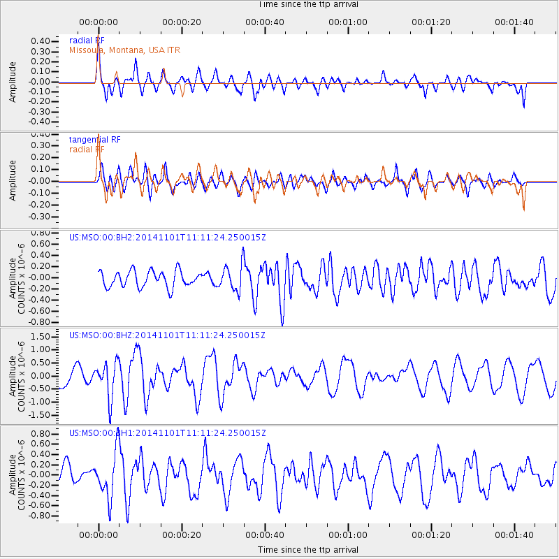
Signal To Noise
| Channel | StoN | STA | LTA |
| US:MSO:00:BHZ:20141101T11:11:24.250015Z | 2.5809493 | 6.955664E-7 | 2.6950022E-7 |
| US:MSO:00:BH1:20141101T11:11:24.250015Z | 2.571835 | 4.6419458E-7 | 1.8049158E-7 |
| US:MSO:00:BH2:20141101T11:11:24.250015Z | 1.6446143 | 2.3307045E-7 | 1.417174E-7 |
| Arrivals |
| Ps | |
| PpPs | |
| PsPs/PpSs | |


