You are here: Home > Network List > UW - Pacific Northwest Regional Seismic Network Stations List
> Station LEBA Lebam, WA, USA > Earthquake Result Viewer
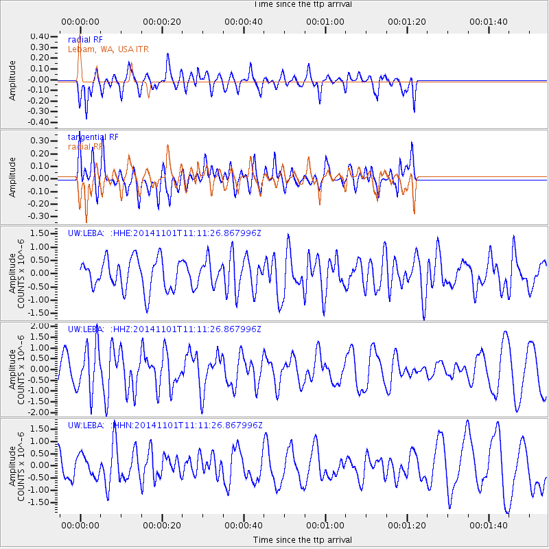
LEBA Lebam, WA, USA - Earthquake Result Viewer
*The percent match for this event was below the threshold and hence no stack was calculated.
| Earthquake location: |
Easter Island Region |
| Earthquake latitude/longitude: |
-31.8/-111.2 |
| Earthquake time(UTC): |
2014/11/01 (305) 10:59:55 GMT |
| Earthquake Depth: |
10 km |
| Earthquake Magnitude: |
6.0 MWP |
| Earthquake Catalog/Contributor: |
NEIC PDE/NEIC COMCAT |
|
| Network: |
UW Pacific Northwest Regional Seismic Network |
| Station: |
LEBA Lebam, WA, USA |
| Lat/Lon: |
46.55 N/123.56 W |
| Elevation: |
73 m |
|
| Distance: |
78.8 deg |
| Az: |
351.321 deg |
| Baz: |
169.275 deg |
| Ray Param: |
$rayparam |
*The percent match for this event was below the threshold and hence was not used in the summary stack. |
|
| Radial Match: |
48.99102 % |
| Radial Bump: |
356 |
| Transverse Match: |
65.69315 % |
| Transverse Bump: |
400 |
| SOD ConfigId: |
813215 |
| Insert Time: |
2014-11-15 11:47:15.886 +0000 |
| GWidth: |
2.5 |
| Max Bumps: |
400 |
| Tol: |
0.001 |
|
Signal To Noise
| Channel | StoN | STA | LTA |
| UW:LEBA: :HHZ:20141101T11:11:26.867996Z | 1.8224972 | 1.1051027E-6 | 6.063673E-7 |
| UW:LEBA: :HHN:20141101T11:11:26.867996Z | 0.80847645 | 4.479312E-7 | 5.5404365E-7 |
| UW:LEBA: :HHE:20141101T11:11:26.867996Z | 0.77955425 | 4.4795976E-7 | 5.7463575E-7 |
| Arrivals |
| Ps | |
| PpPs | |
| PsPs/PpSs | |


