You are here: Home > Network List > UW - Pacific Northwest Regional Seismic Network Stations List
> Station MRBL Marblemount, WA, USA > Earthquake Result Viewer
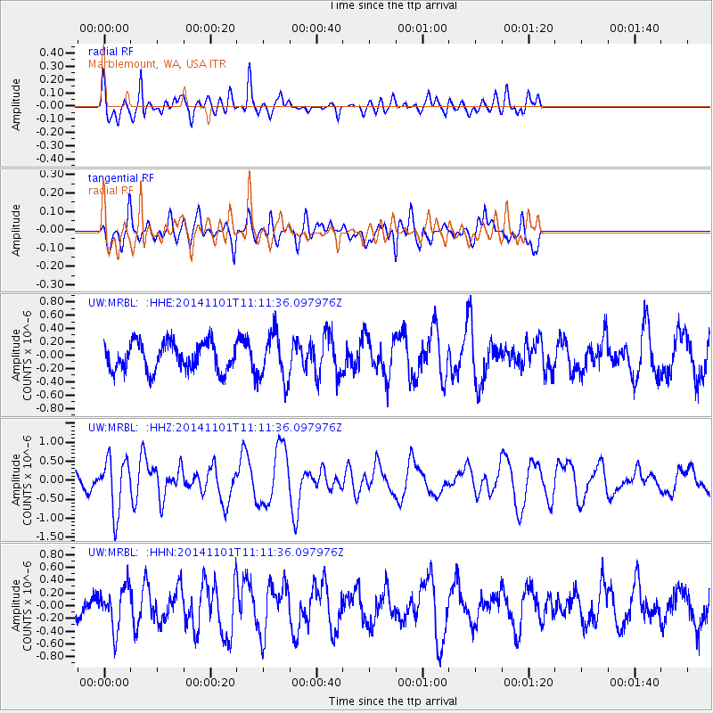
MRBL Marblemount, WA, USA - Earthquake Result Viewer
*The percent match for this event was below the threshold and hence no stack was calculated.
| Earthquake location: |
Easter Island Region |
| Earthquake latitude/longitude: |
-31.8/-111.2 |
| Earthquake time(UTC): |
2014/11/01 (305) 10:59:55 GMT |
| Earthquake Depth: |
10 km |
| Earthquake Magnitude: |
6.0 MWP |
| Earthquake Catalog/Contributor: |
NEIC PDE/NEIC COMCAT |
|
| Network: |
UW Pacific Northwest Regional Seismic Network |
| Station: |
MRBL Marblemount, WA, USA |
| Lat/Lon: |
48.52 N/121.48 W |
| Elevation: |
75 m |
|
| Distance: |
80.5 deg |
| Az: |
353.074 deg |
| Baz: |
171.118 deg |
| Ray Param: |
$rayparam |
*The percent match for this event was below the threshold and hence was not used in the summary stack. |
|
| Radial Match: |
76.102486 % |
| Radial Bump: |
400 |
| Transverse Match: |
69.088905 % |
| Transverse Bump: |
400 |
| SOD ConfigId: |
813215 |
| Insert Time: |
2014-11-15 11:47:25.597 +0000 |
| GWidth: |
2.5 |
| Max Bumps: |
400 |
| Tol: |
0.001 |
|
Signal To Noise
| Channel | StoN | STA | LTA |
| UW:MRBL: :HHZ:20141101T11:11:36.097976Z | 3.9865353 | 7.1041126E-7 | 1.7820268E-7 |
| UW:MRBL: :HHN:20141101T11:11:36.097976Z | 1.8745942 | 3.2615984E-7 | 1.7398956E-7 |
| UW:MRBL: :HHE:20141101T11:11:36.097976Z | 1.6947632 | 3.5446408E-7 | 2.0915257E-7 |
| Arrivals |
| Ps | |
| PpPs | |
| PsPs/PpSs | |


