You are here: Home > Network List > TA - USArray Transportable Network (new EarthScope stations) Stations List
> Station I23K Minto, Yukon-Koyukuk, AK, USA > Earthquake Result Viewer
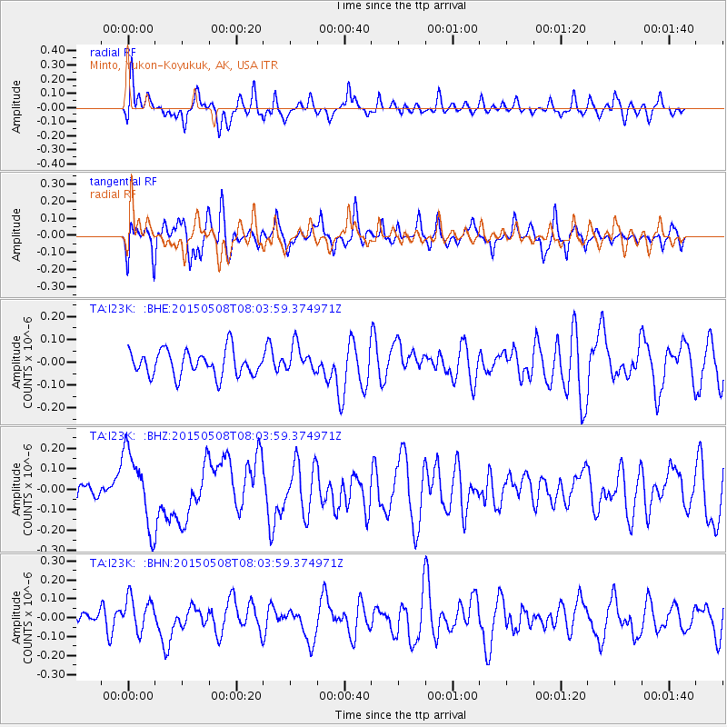
I23K Minto, Yukon-Koyukuk, AK, USA - Earthquake Result Viewer
*The percent match for this event was below the threshold and hence no stack was calculated.
| Earthquake location: |
New Britain Region, P.N.G. |
| Earthquake latitude/longitude: |
-6.1/149.9 |
| Earthquake time(UTC): |
2015/05/08 (128) 07:52:06 GMT |
| Earthquake Depth: |
47 km |
| Earthquake Magnitude: |
5.9 MW |
| Earthquake Catalog/Contributor: |
ISC/ISC |
|
| Network: |
TA USArray Transportable Network (new EarthScope stations) |
| Station: |
I23K Minto, Yukon-Koyukuk, AK, USA |
| Lat/Lon: |
65.15 N/149.36 W |
| Elevation: |
149 m |
|
| Distance: |
83.7 deg |
| Az: |
21.773 deg |
| Baz: |
240.783 deg |
| Ray Param: |
$rayparam |
*The percent match for this event was below the threshold and hence was not used in the summary stack. |
|
| Radial Match: |
56.395977 % |
| Radial Bump: |
400 |
| Transverse Match: |
53.449955 % |
| Transverse Bump: |
400 |
| SOD ConfigId: |
7422571 |
| Insert Time: |
2019-04-18 18:17:59.984 +0000 |
| GWidth: |
2.5 |
| Max Bumps: |
400 |
| Tol: |
0.001 |
|
Signal To Noise
| Channel | StoN | STA | LTA |
| TA:I23K: :BHZ:20150508T08:03:59.374971Z | 2.4981232 | 1.8218164E-7 | 7.2927406E-8 |
| TA:I23K: :BHN:20150508T08:03:59.374971Z | 1.173198 | 9.164771E-8 | 7.811786E-8 |
| TA:I23K: :BHE:20150508T08:03:59.374971Z | 1.0814636 | 5.980527E-8 | 5.53003E-8 |
| Arrivals |
| Ps | |
| PpPs | |
| PsPs/PpSs | |


