You are here: Home > Network List > UW - Pacific Northwest Regional Seismic Network Stations List
> Station LEBA Lebam, WA, USA > Earthquake Result Viewer
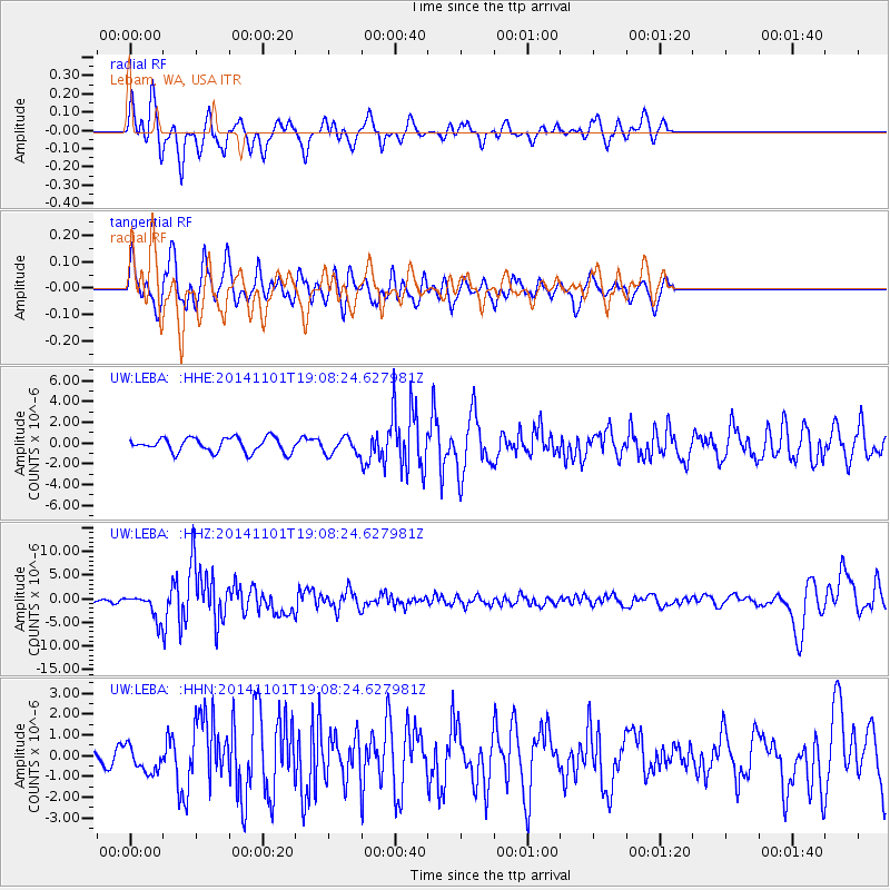
LEBA Lebam, WA, USA - Earthquake Result Viewer
*The percent match for this event was below the threshold and hence no stack was calculated.
| Earthquake location: |
Fiji Islands Region |
| Earthquake latitude/longitude: |
-19.7/-177.7 |
| Earthquake time(UTC): |
2014/11/01 (305) 18:57:22 GMT |
| Earthquake Depth: |
434 km |
| Earthquake Magnitude: |
7.1 MWW, 6.9 MI, 7.1 MWC, 7.2 MWB |
| Earthquake Catalog/Contributor: |
NEIC PDE/NEIC COMCAT |
|
| Network: |
UW Pacific Northwest Regional Seismic Network |
| Station: |
LEBA Lebam, WA, USA |
| Lat/Lon: |
46.55 N/123.56 W |
| Elevation: |
73 m |
|
| Distance: |
82.1 deg |
| Az: |
34.401 deg |
| Baz: |
230.468 deg |
| Ray Param: |
$rayparam |
*The percent match for this event was below the threshold and hence was not used in the summary stack. |
|
| Radial Match: |
76.70795 % |
| Radial Bump: |
400 |
| Transverse Match: |
67.975655 % |
| Transverse Bump: |
400 |
| SOD ConfigId: |
813215 |
| Insert Time: |
2014-11-15 19:34:21.961 +0000 |
| GWidth: |
2.5 |
| Max Bumps: |
400 |
| Tol: |
0.001 |
|
Signal To Noise
| Channel | StoN | STA | LTA |
| UW:LEBA: :HHZ:20141101T19:08:24.627981Z | 6.8629146 | 2.6271352E-6 | 3.8280166E-7 |
| UW:LEBA: :HHN:20141101T19:08:24.627981Z | 1.6382875 | 6.305546E-7 | 3.8488642E-7 |
| UW:LEBA: :HHE:20141101T19:08:24.627981Z | 1.1727335 | 8.0339316E-7 | 6.850603E-7 |
| Arrivals |
| Ps | |
| PpPs | |
| PsPs/PpSs | |


