You are here: Home > Network List > CN - Canadian National Seismograph Network Stations List
> Station INK INUVIK, NT > Earthquake Result Viewer
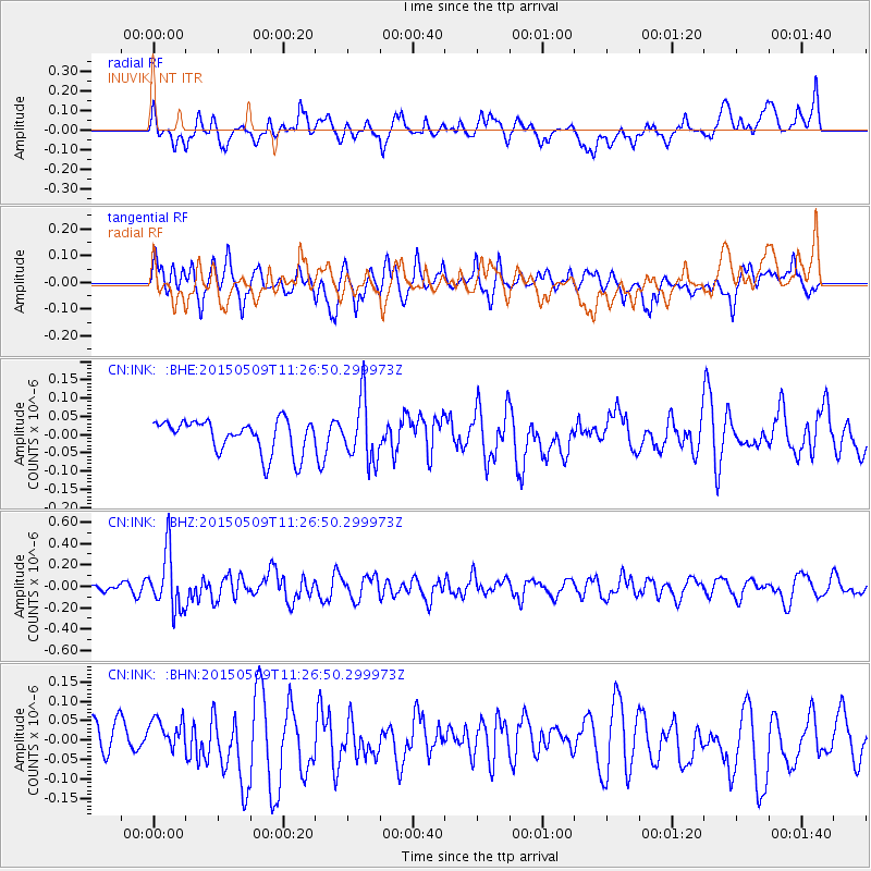
INK INUVIK, NT - Earthquake Result Viewer
*The percent match for this event was below the threshold and hence no stack was calculated.
| Earthquake location: |
New Britain Region, P.N.G. |
| Earthquake latitude/longitude: |
-5.8/151.6 |
| Earthquake time(UTC): |
2015/05/09 (129) 11:14:28 GMT |
| Earthquake Depth: |
49 km |
| Earthquake Magnitude: |
5.6 MW |
| Earthquake Catalog/Contributor: |
ISC/ISC |
|
| Network: |
CN Canadian National Seismograph Network |
| Station: |
INK INUVIK, NT |
| Lat/Lon: |
68.31 N/133.53 W |
| Elevation: |
44 m |
|
| Distance: |
89.8 deg |
| Az: |
21.029 deg |
| Baz: |
253.786 deg |
| Ray Param: |
$rayparam |
*The percent match for this event was below the threshold and hence was not used in the summary stack. |
|
| Radial Match: |
58.8504 % |
| Radial Bump: |
400 |
| Transverse Match: |
53.376305 % |
| Transverse Bump: |
400 |
| SOD ConfigId: |
7422571 |
| Insert Time: |
2019-04-18 18:37:16.807 +0000 |
| GWidth: |
2.5 |
| Max Bumps: |
400 |
| Tol: |
0.001 |
|
Signal To Noise
| Channel | StoN | STA | LTA |
| CN:INK: :BHZ:20150509T11:26:50.299973Z | 4.1404624 | 2.6697762E-7 | 6.448015E-8 |
| CN:INK: :BHN:20150509T11:26:50.299973Z | 0.78586054 | 4.0696705E-8 | 5.1786166E-8 |
| CN:INK: :BHE:20150509T11:26:50.299973Z | 1.8892119 | 8.396592E-8 | 4.444495E-8 |
| Arrivals |
| Ps | |
| PpPs | |
| PsPs/PpSs | |


