You are here: Home > Network List > TA - USArray Transportable Network (new EarthScope stations) Stations List
> Station P54A Burton, WV, USA > Earthquake Result Viewer
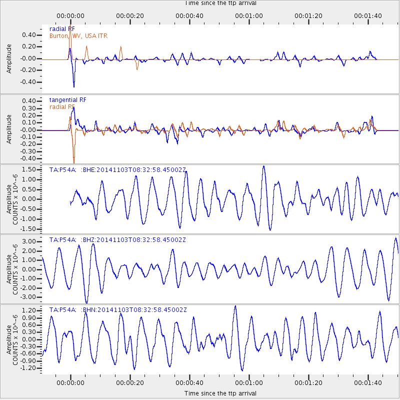
P54A Burton, WV, USA - Earthquake Result Viewer
*The percent match for this event was below the threshold and hence no stack was calculated.
| Earthquake location: |
Central Mid-Atlantic Ridge |
| Earthquake latitude/longitude: |
4.7/-32.7 |
| Earthquake time(UTC): |
2014/11/03 (307) 08:23:55 GMT |
| Earthquake Depth: |
10 km |
| Earthquake Magnitude: |
5.5 MB |
| Earthquake Catalog/Contributor: |
NEIC PDE/NEIC COMCAT |
|
| Network: |
TA USArray Transportable Network (new EarthScope stations) |
| Station: |
P54A Burton, WV, USA |
| Lat/Lon: |
39.61 N/80.48 W |
| Elevation: |
473 m |
|
| Distance: |
55.4 deg |
| Az: |
315.915 deg |
| Baz: |
116.147 deg |
| Ray Param: |
$rayparam |
*The percent match for this event was below the threshold and hence was not used in the summary stack. |
|
| Radial Match: |
79.91891 % |
| Radial Bump: |
400 |
| Transverse Match: |
66.97952 % |
| Transverse Bump: |
400 |
| SOD ConfigId: |
815141 |
| Insert Time: |
2014-11-17 08:51:27.430 +0000 |
| GWidth: |
2.5 |
| Max Bumps: |
400 |
| Tol: |
0.001 |
|
Signal To Noise
| Channel | StoN | STA | LTA |
| TA:P54A: :BHZ:20141103T08:32:58.45002Z | 1.9338427 | 1.7044423E-6 | 8.813759E-7 |
| TA:P54A: :BHN:20141103T08:32:58.45002Z | 1.1846281 | 5.5745477E-7 | 4.7057364E-7 |
| TA:P54A: :BHE:20141103T08:32:58.45002Z | 1.2356657 | 6.7732776E-7 | 5.481481E-7 |
| Arrivals |
| Ps | |
| PpPs | |
| PsPs/PpSs | |


