You are here: Home > Network List > UW - Pacific Northwest Regional Seismic Network Stations List
> Station UMAT Pilot Rock, OR, USA > Earthquake Result Viewer
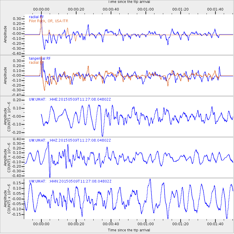
UMAT Pilot Rock, OR, USA - Earthquake Result Viewer
*The percent match for this event was below the threshold and hence no stack was calculated.
| Earthquake location: |
New Britain Region, P.N.G. |
| Earthquake latitude/longitude: |
-5.8/151.6 |
| Earthquake time(UTC): |
2015/05/09 (129) 11:14:28 GMT |
| Earthquake Depth: |
49 km |
| Earthquake Magnitude: |
5.6 MW |
| Earthquake Catalog/Contributor: |
ISC/ISC |
|
| Network: |
UW Pacific Northwest Regional Seismic Network |
| Station: |
UMAT Pilot Rock, OR, USA |
| Lat/Lon: |
45.29 N/118.96 W |
| Elevation: |
1318 m |
|
| Distance: |
93.7 deg |
| Az: |
45.017 deg |
| Baz: |
265.478 deg |
| Ray Param: |
$rayparam |
*The percent match for this event was below the threshold and hence was not used in the summary stack. |
|
| Radial Match: |
62.36918 % |
| Radial Bump: |
386 |
| Transverse Match: |
36.80395 % |
| Transverse Bump: |
400 |
| SOD ConfigId: |
7422571 |
| Insert Time: |
2019-04-18 18:39:43.149 +0000 |
| GWidth: |
2.5 |
| Max Bumps: |
400 |
| Tol: |
0.001 |
|
Signal To Noise
| Channel | StoN | STA | LTA |
| UW:UMAT: :HHZ:20150509T11:27:08.04802Z | 2.5355191 | 1.7993177E-7 | 7.0964475E-8 |
| UW:UMAT: :HHN:20150509T11:27:08.04802Z | 0.50761694 | 3.7350308E-8 | 7.357971E-8 |
| UW:UMAT: :HHE:20150509T11:27:08.04802Z | 1.641989 | 1.15628715E-7 | 7.041991E-8 |
| Arrivals |
| Ps | |
| PpPs | |
| PsPs/PpSs | |


