You are here: Home > Network List > CI - Caltech Regional Seismic Network Stations List
> Station MPM Manuel Prospect Mine, California, USA > Earthquake Result Viewer
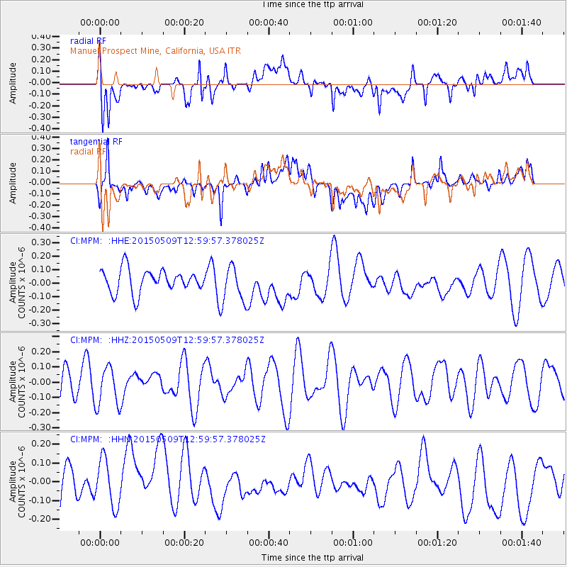
MPM Manuel Prospect Mine, California, USA - Earthquake Result Viewer
*The percent match for this event was below the threshold and hence no stack was calculated.
| Earthquake location: |
New Britain Region, P.N.G. |
| Earthquake latitude/longitude: |
-5.9/151.7 |
| Earthquake time(UTC): |
2015/05/09 (129) 12:47:14 GMT |
| Earthquake Depth: |
41 km |
| Earthquake Magnitude: |
4.7 mb |
| Earthquake Catalog/Contributor: |
ISC/ISC |
|
| Network: |
CI Caltech Regional Seismic Network |
| Station: |
MPM Manuel Prospect Mine, California, USA |
| Lat/Lon: |
36.06 N/117.49 W |
| Elevation: |
185 m |
|
| Distance: |
94.1 deg |
| Az: |
54.32 deg |
| Baz: |
265.758 deg |
| Ray Param: |
$rayparam |
*The percent match for this event was below the threshold and hence was not used in the summary stack. |
|
| Radial Match: |
57.679573 % |
| Radial Bump: |
400 |
| Transverse Match: |
55.372585 % |
| Transverse Bump: |
400 |
| SOD ConfigId: |
7422571 |
| Insert Time: |
2019-04-18 18:42:08.366 +0000 |
| GWidth: |
2.5 |
| Max Bumps: |
400 |
| Tol: |
0.001 |
|
Signal To Noise
| Channel | StoN | STA | LTA |
| CI:MPM: :HHZ:20150509T12:59:57.378025Z | 0.958914 | 1.2924184E-7 | 1.347794E-7 |
| CI:MPM: :HHN:20150509T12:59:57.378025Z | 0.9606605 | 1.3339225E-7 | 1.3885473E-7 |
| CI:MPM: :HHE:20150509T12:59:57.378025Z | 1.5522085 | 1.3077695E-7 | 8.425218E-8 |
| Arrivals |
| Ps | |
| PpPs | |
| PsPs/PpSs | |


