You are here: Home > Network List > TA - USArray Transportable Network (new EarthScope stations) Stations List
> Station A21K Barrow, AK, USA > Earthquake Result Viewer
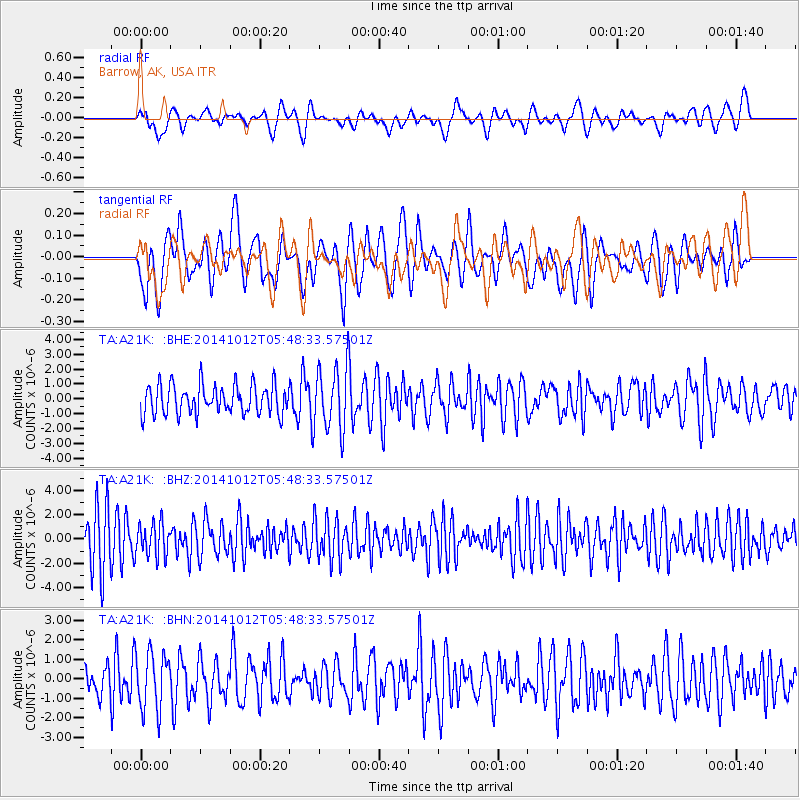
A21K Barrow, AK, USA - Earthquake Result Viewer
*The percent match for this event was below the threshold and hence no stack was calculated.
| Earthquake location: |
Reykjanes Ridge |
| Earthquake latitude/longitude: |
57.3/-33.3 |
| Earthquake time(UTC): |
2014/10/12 (285) 05:40:43 GMT |
| Earthquake Depth: |
10 km |
| Earthquake Magnitude: |
5.6 MWW, 5.5 MWC |
| Earthquake Catalog/Contributor: |
NEIC PDE/NEIC COMCAT |
|
| Network: |
TA USArray Transportable Network (new EarthScope stations) |
| Station: |
A21K Barrow, AK, USA |
| Lat/Lon: |
71.32 N/156.62 W |
| Elevation: |
577 m |
|
| Distance: |
45.7 deg |
| Az: |
337.901 deg |
| Baz: |
39.351 deg |
| Ray Param: |
$rayparam |
*The percent match for this event was below the threshold and hence was not used in the summary stack. |
|
| Radial Match: |
52.19453 % |
| Radial Bump: |
400 |
| Transverse Match: |
48.124695 % |
| Transverse Bump: |
400 |
| SOD ConfigId: |
815311 |
| Insert Time: |
2014-11-19 10:53:29.209 +0000 |
| GWidth: |
2.5 |
| Max Bumps: |
400 |
| Tol: |
0.001 |
|
Signal To Noise
| Channel | StoN | STA | LTA |
| TA:A21K: :BHZ:20141012T05:48:33.57501Z | 0.85473454 | 1.3507882E-6 | 1.5803599E-6 |
| TA:A21K: :BHN:20141012T05:48:33.57501Z | 1.8632596 | 1.4694059E-6 | 7.8862115E-7 |
| TA:A21K: :BHE:20141012T05:48:33.57501Z | 2.1782534 | 2.1622864E-6 | 9.926698E-7 |
| Arrivals |
| Ps | |
| PpPs | |
| PsPs/PpSs | |


