You are here: Home > Network List > US - United States National Seismic Network Stations List
> Station DGMT Dagmar, Montana, USA > Earthquake Result Viewer
DGMT Dagmar, Montana, USA - Earthquake Result Viewer
*The percent match for this event was below the threshold and hence no stack was calculated.
| Earthquake location: |
Kuril Islands |
| Earthquake latitude/longitude: |
46.4/153.0 |
| Earthquake time(UTC): |
2015/05/09 (129) 14:12:35 GMT |
| Earthquake Depth: |
150 km |
| Earthquake Magnitude: |
3.1 mb |
| Earthquake Catalog/Contributor: |
ISC/ISC |
|
| Network: |
US United States National Seismic Network |
| Station: |
DGMT Dagmar, Montana, USA |
| Lat/Lon: |
48.47 N/104.20 W |
| Elevation: |
0.0 m |
|
| Distance: |
64.1 deg |
| Az: |
46.144 deg |
| Baz: |
311.366 deg |
| Ray Param: |
$rayparam |
*The percent match for this event was below the threshold and hence was not used in the summary stack. |
|
| Radial Match: |
47.868332 % |
| Radial Bump: |
391 |
| Transverse Match: |
40.550594 % |
| Transverse Bump: |
339 |
| SOD ConfigId: |
7422571 |
| Insert Time: |
2019-04-18 18:51:26.007 +0000 |
| GWidth: |
2.5 |
| Max Bumps: |
400 |
| Tol: |
0.001 |
|
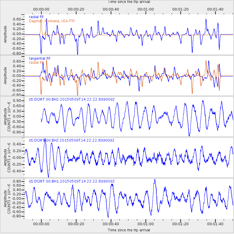
Signal To Noise
| Channel | StoN | STA | LTA |
| US:DGMT:00:BHZ:20150509T14:22:22.899009Z | 1.8899573 | 3.6534036E-7 | 1.9330615E-7 |
| US:DGMT:00:BH1:20150509T14:22:22.899009Z | 1.0236137 | 2.6842798E-7 | 2.622356E-7 |
| US:DGMT:00:BH2:20150509T14:22:22.899009Z | 0.8625954 | 3.066077E-7 | 3.5544787E-7 |
| Arrivals |
| Ps | |
| PpPs | |
| PsPs/PpSs | |


