You are here: Home > Network List > CN - Canadian National Seismograph Network Stations List
> Station INK INUVIK, NT > Earthquake Result Viewer
INK INUVIK, NT - Earthquake Result Viewer
*The percent match for this event was below the threshold and hence no stack was calculated.
| Earthquake location: |
New Britain Region, P.N.G. |
| Earthquake latitude/longitude: |
-6.0/148.2 |
| Earthquake time(UTC): |
2014/11/07 (311) 03:33:54 GMT |
| Earthquake Depth: |
43 km |
| Earthquake Magnitude: |
6.6 MWW, 6.6 MWB, 6.9 MI |
| Earthquake Catalog/Contributor: |
NEIC PDE/NEIC COMCAT |
|
| Network: |
CN Canadian National Seismograph Network |
| Station: |
INK INUVIK, NT |
| Lat/Lon: |
68.31 N/133.53 W |
| Elevation: |
44 m |
|
| Distance: |
91.3 deg |
| Az: |
21.353 deg |
| Baz: |
256.896 deg |
| Ray Param: |
$rayparam |
*The percent match for this event was below the threshold and hence was not used in the summary stack. |
|
| Radial Match: |
69.78241 % |
| Radial Bump: |
400 |
| Transverse Match: |
51.9524 % |
| Transverse Bump: |
400 |
| SOD ConfigId: |
815426 |
| Insert Time: |
2014-11-21 03:48:17.212 +0000 |
| GWidth: |
2.5 |
| Max Bumps: |
400 |
| Tol: |
0.001 |
|
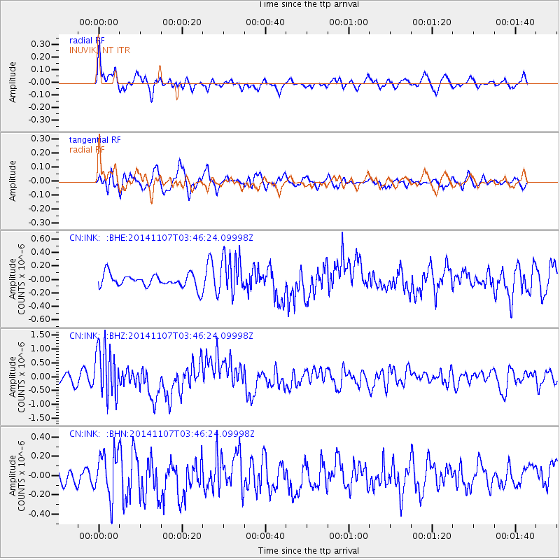
Signal To Noise
| Channel | StoN | STA | LTA |
| CN:INK: :BHZ:20141107T03:46:24.09998Z | 7.5993466 | 9.08872E-7 | 1.195987E-7 |
| CN:INK: :BHN:20141107T03:46:24.09998Z | 2.0725143 | 2.2868214E-7 | 1.10340444E-7 |
| CN:INK: :BHE:20141107T03:46:24.09998Z | 2.9960535 | 2.899569E-7 | 9.6779615E-8 |
| Arrivals |
| Ps | |
| PpPs | |
| PsPs/PpSs | |


