You are here: Home > Network List > TA - USArray Transportable Network (new EarthScope stations) Stations List
> Station O48A Farmland, IN, USA > Earthquake Result Viewer
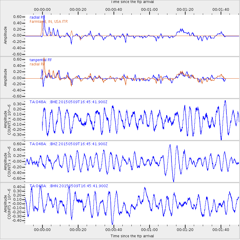
O48A Farmland, IN, USA - Earthquake Result Viewer
*The percent match for this event was below the threshold and hence no stack was calculated.
| Earthquake location: |
Kuril Islands |
| Earthquake latitude/longitude: |
47.9/153.2 |
| Earthquake time(UTC): |
2015/05/09 (129) 16:34:27 GMT |
| Earthquake Depth: |
125 km |
| Earthquake Magnitude: |
4.5 mb |
| Earthquake Catalog/Contributor: |
ISC/ISC |
|
| Network: |
TA USArray Transportable Network (new EarthScope stations) |
| Station: |
O48A Farmland, IN, USA |
| Lat/Lon: |
40.26 N/85.16 W |
| Elevation: |
300 m |
|
| Distance: |
78.1 deg |
| Az: |
41.766 deg |
| Baz: |
324.122 deg |
| Ray Param: |
$rayparam |
*The percent match for this event was below the threshold and hence was not used in the summary stack. |
|
| Radial Match: |
59.10483 % |
| Radial Bump: |
400 |
| Transverse Match: |
52.07469 % |
| Transverse Bump: |
400 |
| SOD ConfigId: |
7422571 |
| Insert Time: |
2019-04-18 18:58:42.341 +0000 |
| GWidth: |
2.5 |
| Max Bumps: |
400 |
| Tol: |
0.001 |
|
Signal To Noise
| Channel | StoN | STA | LTA |
| TA:O48A: :BHZ:20150509T16:45:41.900Z | 0.5159669 | 1.3219399E-7 | 2.5620633E-7 |
| TA:O48A: :BHN:20150509T16:45:41.900Z | 1.4354278 | 2.2080565E-7 | 1.5382567E-7 |
| TA:O48A: :BHE:20150509T16:45:41.900Z | 1.1255348 | 1.6518706E-7 | 1.4676317E-7 |
| Arrivals |
| Ps | |
| PpPs | |
| PsPs/PpSs | |


